
Latitude and longitude for kids

Latitude and longitude are lines on a map or globe that let us give any place on Earth an exact address. Latitude says how far north or south a place is. Longitude says how far east or west. Together they’re called coordinates.
Latitude: north and south
Lines of latitude go around the Earth like rings. They run east to west, but they measure how far north or south you are. The equator is 0° latitude: it goes around the middle of the Earth, about 24,901 miles around, and splits it into the Northern and Southern Hemispheres. Latitude goes up to 90° at the North Pole (90° N) and the South Pole (90° S).
A few lines of latitude have names:
- The Tropic of Cancer, about 23.5° north, and the Tropic of Capricorn, about the same distance south.
- The Arctic Circle and the Antarctic Circle, near the poles.
A trick: latitude lines are flat, like the rungs of a ladder, so think “lat” and “ladder”.
Longitude: east and west
Lines of longitude, also called meridians, run from the North Pole to the South Pole, but they measure how far east or west you are. The prime meridian is 0° longitude, and it runs through Greenwich, England. Longitude goes 180° east and 180° west, and they meet on the other side of the Earth at 180°.
A trick: longitude lines are all long, from pole to pole.
Why Greenwich?
In 1884, people from many countries met in Washington, D.C., to choose one prime meridian for the whole world. They chose the line through Greenwich, in London, because nearly two-thirds of the world’s ships already used sea charts based on it, so it meant the least change.
How to read coordinates
A place’s coordinates are its latitude, then its longitude. For example, the National Park Service gives the Statue of Liberty’s location as about 40.69° N, 74.05° W: about 40 degrees north of the equator and 74 degrees west of Greenwich.
Degrees can be split into smaller parts for more exact spots: one degree is 60 minutes, and one minute is 60 seconds. So you might also see coordinates written like 40° 41′ N.
Sometimes coordinates are written with a minus sign instead of a letter: a minus in front of a latitude means south, and in front of a longitude means west. So 40.69, −74.05 is the same spot as 40.69° N, 74.05° W.
Play: find it by its coordinates
What’s at these coordinates?
The game needs JavaScript. The printable map below has questions to try on paper.
The lines are every 30°. Some answers sit halfway between two lines, at 15°, 45° or 75°. After each answer, a dot shows the spot; press “Next question” when you’re ready. Nothing is saved or sent anywhere.
Print the map and questions
-
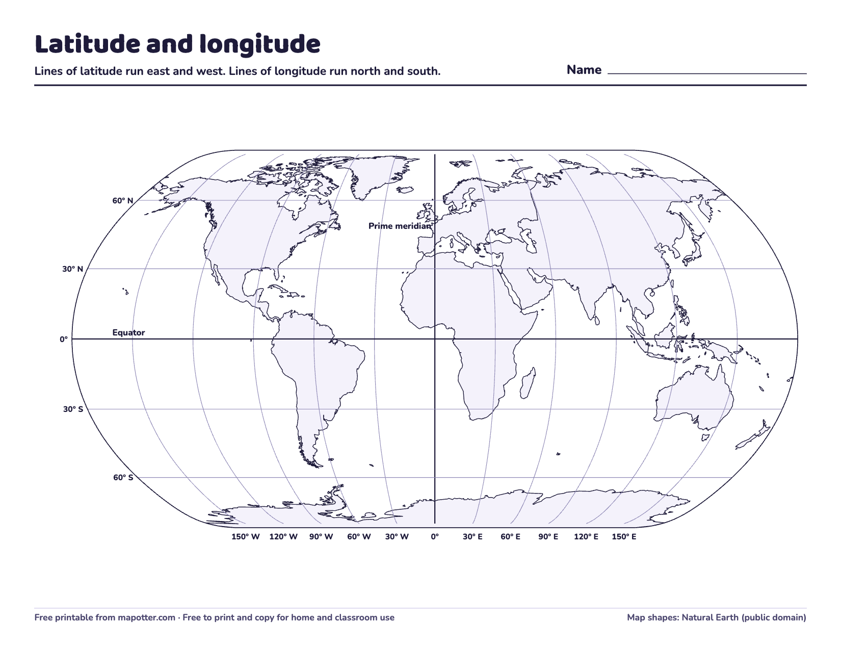
Latitude and longitude map
A world map with lines every 30 degrees, eight questions and an answer key.
PDF · 3 pages · 90 KB · US Letter, landscape
Download the latitude and longitude map PDF
Things to try
- Find your home. Look up your town’s coordinates and mark it on the printable map.
- Which hemisphere? Is your home north or south of the equator? East or west of the prime meridian?
- Coordinate hunt. One person picks a spot on the map and reads out its rough coordinates; the other finds it.
New to world maps? Start with the 7 continents and 5 oceans and map skills for kids.
How Map Otter helps
Older kids get this in Map Otter too, the geography app we’re building for ages 4 to 13. Its Trailblazers track, for 5th to 7th grade, has a cleaner, map-first look with latitude and longitude lines. It has no ads, no tracking and no accounts, and it’s coming soon to iPhone, iPad, Android and Chromebooks.
