
Canada for kids: provinces, territories and capitals
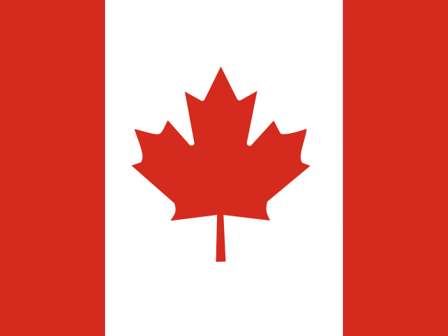
Canada is the United States’ neighbor to the north, and the second-largest country in the world. It has ten provinces and three territories, and its capital is Ottawa. Here they all are, with their capitals and some fun facts.
The provinces and territories and their capitals
From east to west, then the three territories in the north:
| Province or territory | Capital | Kind |
|---|---|---|
| Newfoundland and Labrador | St. John’s | Province |
| Prince Edward Island | Charlottetown | Province |
| Nova Scotia | Halifax | Province |
| New Brunswick | Fredericton | Province |
| Quebec | Québec City | Province |
| Ontario | Toronto | Province |
| Manitoba | Winnipeg | Province |
| Saskatchewan | Regina | Province |
| Alberta | Edmonton | Province |
| British Columbia | Victoria | Province |
| Yukon | Whitehorse | Territory |
| Northwest Territories | Yellowknife | Territory |
| Nunavut | Iqaluit | Territory |
Canada and the United States
Canada and the United States share the longest border between two countries in the world: about 5,524 miles (8,890 kilometers), counting Alaska’s. Seven provinces and one territory touch the US: New Brunswick, Quebec, Ontario, Manitoba, Saskatchewan, Alberta, British Columbia and Yukon.
On the US side, 13 states touch Canada: Maine, New Hampshire, Vermont, New York, Pennsylvania, Ohio, Michigan, Minnesota, North Dakota, Montana, Idaho, Washington and Alaska.
Canada’s five regions
The Government of Canada splits the country into five regions. Learning them first makes the 13 names much easier:
- The Atlantic Provinces: Newfoundland and Labrador, Prince Edward Island, Nova Scotia and New Brunswick, on the Atlantic Ocean.
- Central Canada: Quebec and Ontario, where more than half of Canadians live.
- The Prairie Provinces: Manitoba, Saskatchewan and Alberta, with flat farmland and the Rocky Mountains in the west of Alberta.
- The West Coast: British Columbia, on the Pacific Ocean.
- The North: Yukon, the Northwest Territories and Nunavut, which cover about a third of Canada.
When each one joined Canada, and its biggest city
Canada began in 1867 with four provinces. The others joined over the next 132 years; Nunavut, the newest, was made in 1999. The capital isn’t always the biggest city: Quebec’s capital is Québec City, but its biggest city is Montreal. In parentheses is each one’s biggest city.
- 1867: Ontario (Toronto), Quebec (Montreal), Nova Scotia (Halifax), New Brunswick (Moncton).
- 1870: Manitoba (Winnipeg), Northwest Territories (Yellowknife).
- 1871: British Columbia (Vancouver).
- 1873: Prince Edward Island (Charlottetown).
- 1898: Yukon (Whitehorse).
- 1905: Alberta (Calgary), Saskatchewan (Saskatoon).
- 1949: Newfoundland and Labrador (St. John’s).
- 1999: Nunavut (Iqaluit).
Fun facts
- Canada has the longest coastline in the world, along three oceans: the Pacific, the Atlantic and the Arctic.
- Queen Victoria chose Ottawa as the capital in 1857.
- Its highest mountain is Mount Logan, in Yukon.
- The far north is called the “Land of the Midnight Sun”.
How to learn them
- Start with the provinces that touch your state, if you live near the border.
- Learn them east to west, like the list above: the four Atlantic provinces, then Quebec and Ontario, then the three Prairie provinces, then British Columbia.
- Save the three territories, in the north, for last.
Check yourself
Cover the answers, say yours out loud, then tap to check.
What is the capital of Canada?
Ottawa, in Ontario.
How many provinces and territories does Canada have?
10 provinces and 3 territories.
Which province is the only one where most people speak French?
Quebec. Its capital is Québec City.
Which is the newest territory?
Nunavut, made in 1999. Its capital is Iqaluit.
Which province is on the Pacific Ocean?
British Columbia. Its capital, Victoria, is on Vancouver Island.
Which three provinces are the Prairie Provinces?
Manitoba, Saskatchewan and Alberta.
See its flag next to its neighbors’ on our flags of the world page, and find it on our continents and oceans maps.
How Map Otter helps
After the United States, Canada is one of the countries Map Otter covers in full detail, the same way it covers the states. Map Otter is the geography app we’re building for kids 4 to 13. It has no ads, no tracking and no accounts, and it’s coming soon to iPhone, iPad, Android and Chromebooks.
Where these facts come from
- Government of Canada, Discover Canada: Canada’s regions
- Statistics Canada: population estimates, second quarter 2026
- Constitution Acts, 1867 to 1982 (official languages)
- Statistics Canada, Canada Year Book: Geography
- International Boundary Commission: interesting facts
- Government of Canada: provinces and territories
- Statistics Canada: 2021 Census population and dwelling counts
