
Washington facts for kids
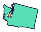
Washington is the Evergreen State (say WASH-ing-tuhn). This is the state in the far northwest, not Washington, D.C., and it grows more apples than any other state.
Quick answers
- Where is Washington?
- Washington is in the West region of the United States. It touches two states: Idaho and Oregon.
- What is the capital of Washington?
- Olympia. The biggest city is Seattle.
- Does Washington touch the ocean?
- Yes. Washington has a coast on the Pacific Ocean.
- How big is Washington?
- 71,298 square miles. It’s the 18th biggest of the 50 states.
Washington at a glance
- Capital
- Olympia
- Nickname
- The Evergreen State
- Region
- West in Map Otter. The US Census Bureau puts it in the West.
- Became a state
- November 11, 1889, the 42nd state
- Biggest city
- Seattle
- Size
- 71,298 square miles, the 18th biggest
- People
- About 8 million (2025), the 13th most
- Neighbors
- Idaho and Oregon
Where is Washington?
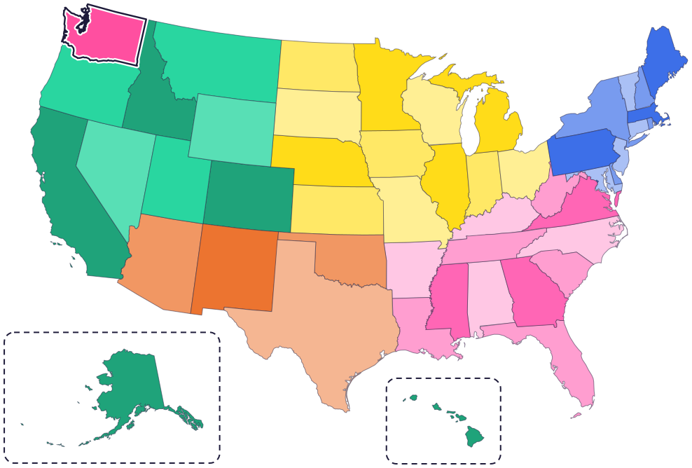
Washington is in the Pacific Northwest, in the top left corner of the lower 48 states. Two states border it: Idaho to the east and Oregon to the south. The Columbia River forms much of its border with Oregon.
To the north is Canada (the province of British Columbia). To the west is the Pacific Ocean, and an arm of the sea called Puget Sound reaches deep into western Washington.
Fun facts
- 1
In 1889, a jeweler named Charles Talcott designed the first state seal using an ink bottle, a silver dollar and a postage stamp.
- 2
The state dinosaur, Suciasaurus rex, is known from part of a thigh bone found on Sucia Island in 2012. It’s the only dinosaur discovered in Washington.
- 3
Students near Cheney worked for four years to make the Columbian mammoth the state fossil. In Seattle, 4th and 5th graders proposed the Olympic marmot.
- 4
Washington is the nation’s top apple-producing state. The apple became a state symbol in 1989, the state’s 100th birthday year.
- 5
In the 1970s, artifacts from 300 to 500 years ago were found at an old Makah village. Only about 1 percent of them are on display at the Makah Museum in Neah Bay.
Places to know
Mount Rainier
West-central Washington
Mount Rainier is 14,410 feet tall. It’s an active volcano and the most glaciated peak in the lower 48 states, and five major rivers start on it.
Olympic National Park
Olympic Peninsula
Nearly a million acres of glacier-capped mountains, old-growth rain forests and more than 70 miles of wild coastline.
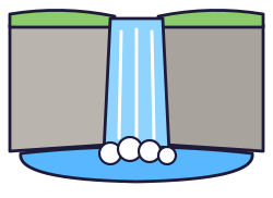
Palouse Falls
Southeast Washington
The state waterfall drops 198 feet. It’s the last waterfall left by the Ice Age floods that flows all year.
Washington long ago
The Makah Tribe has called the Neah Bay area, at the northwest tip of the lower 48 states, home since time immemorial. In the early 1800s, its five villages were home to 2,000 to 4,000 Makah.
On March 2, President Millard Fillmore signs the law that creates Washington Territory.
Makah leaders sign the Treaty of Neah Bay with the United States. They give up about 300,000 acres of land to protect their right to hunt whales.
Washington joins the Union on November 11, as the 42nd state.
A state law describes Washington’s flag: dark green, with the state seal in the center.
State symbols
- State marine mammalOrcasince 2005
- State birdWillow goldfinchsince 1951
- State treeWestern hemlocksince 1947
- State fossilColumbian mammothsince 1998
- State dinosaurSuciasaurus rexsince 2023
Tricks to remember Washington
- Top left corner. Washington is the state in the top left (northwest) corner of the lower 48.
- Two Washingtons. Washington state is on the Pacific coast. Washington, D.C. is all the way across the country, on the East Coast.
- Olympia is at the bottom of the Sound. The capital sits at the southern tip of Puget Sound, the long arm of the sea in the west.
- Evergreen and green. Picture evergreen forests, then the state’s dark green flag.
To practice, print a blank US map and color in Washington, or find it in the 50 states quiz. Then try today’s mystery state: guess it from its shape, with a clue after each miss.
Teaching all 50? Read how to teach kids the 50 states and what age kids learn the states and capitals, or follow our free 36-week homeschool geography plan.
Washington in Map Otter
In Map Otter, kids find Washington on the map, learn its capital, and collect its stamp in their passport, with Otto guiding the way. These screenshots show how it looks with a few example states.



Map Otter is coming soon to iPhone, iPad, Android phones and tablets, and Chromebooks.
Questions kids ask
What is the capital of Washington?
Olympia. It’s at the southern end of Puget Sound, southwest of Seattle.
Is Washington state the same as Washington, D.C.?
No. Washington, D.C., the nation’s capital, is on the East Coast. Washington state is all the way across the country, in the far northwest.
Why is Washington called the Evergreen State?
For its evergreen forests. C.T. Conover, a Seattle pioneer, gave it the nickname, but it has never been made official.
What is the biggest city in Washington?
Seattle. Next come Spokane and Tacoma.
Where these facts come from
- Washington State Legislature: state symbols
- Washington State Legislature: state nickname
- Washington State Legislature: state seal
- Washington State Legislature: state flag
- Washington State Legislature: state dinosaur
- Washington State Legislature: state fossil
- Washington State Legislature: state endemic mammal
- Washington State Legislature: state fruit
- Washington State Legislature: state waterfall
- Washington State Legislature: territorial history
- RCW 1.20.037: state marine mammal
- RCW 1.20.040: state bird
- RCW 1.20.020: state tree
- RCW 1.20.042: state fossil
- RCW 1.20.041: state dinosaur
- Makah Tribe
- Makah Tribe: history
- National Park Service: Mount Rainier
- National Park Service: Olympic National Park
- US Census Bureau: state area measurements
- US Census Bureau: state population estimates, 2020 to 2025
- US Census Bureau: city and town population estimates, 2020 to 2025
- US Senate Manual: ratification of the Constitution by the 13 original states
- US Senate Manual: states admitted into the Union
- US Census Bureau: census regions and divisions
- NOAA Office for Coastal Management: shoreline mileage of the United States
