
Louisiana facts for kids
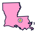
In Louisiana, the Pelican State (say loo-ee-zee-AN-uh), the map is split into parishes instead of counties. It also has America’s largest freshwater swamp.
Quick answers
- Where is Louisiana?
- Louisiana is in the Southeast region of the United States. It touches three states: Arkansas, Mississippi and Texas.
- What is the capital of Louisiana?
- Baton Rouge. The biggest city is New Orleans.
- Does Louisiana touch the ocean?
- Yes. Louisiana has a coast on the Gulf, which is part of the Atlantic Ocean.
- How big is Louisiana?
- 52,378 square miles. It’s the 31st biggest of the 50 states.
Louisiana at a glance
- Capital
- Baton Rouge
- Nickname
- The Pelican State
- Region
- Southeast in Map Otter. The US Census Bureau puts it in the South.
- Became a state
- April 30, 1812, the 18th state
- Biggest city
- New Orleans
- Size
- 52,378 square miles, the 31st biggest
- People
- About 4.6 million (2025), the 25th most
- Neighbors
- Arkansas, Mississippi and Texas
Where is Louisiana?
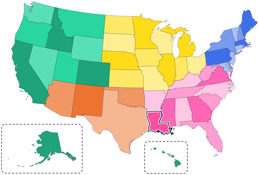
Louisiana is in the South, on the Gulf Coast. Three states share its borders: Texas to the west, Arkansas to the north and Mississippi to the east.
To the south is the Gulf, with marshes, bayous and islands along the coast. The Mississippi River flows through Louisiana, past Baton Rouge and New Orleans, on its way to the Gulf.
Fun facts
- 1
Louisiana is divided into parishes, not counties.
- 2
The Chitimacha Tribe is the only tribe in Louisiana that still lives on part of its original homeland, near Charenton. Chitimacha weavers make baskets from river cane.
- 3
The Atchafalaya River Basin is America’s largest freshwater swamp.
- 4
Louisiana’s flag shows a mother pelican feeding her babies, with the state motto: “Union, Justice, and Confidence.”
- 5
Over the years, the flags of Spain, France, Great Britain and the United States have all flown over Louisiana.
Places to know

Poverty Point
North Louisiana
American Indians built huge earthworks here more than 3,000 years ago, including a mound 72 feet tall and six rows of curved ridges. It became a UNESCO World Heritage Site in 2014.

Barataria Preserve
Near New Orleans
This part of Jean Lafitte National Historical Park and Preserve has 26,000 acres of swamps, marshes, bayous and forests, home to alligators and more than 200 kinds of birds. Starting in 2026, most trails and the visitor center are closed for about two years of repairs, so check before you go.

Louisiana’s Old State Capitol
Baton Rouge
Built between 1847 and 1852, it looks like a castle from the outside. Inside, stained glass shines in the main gallery and in a skylight overhead.
Louisiana long ago
American Indians build giant earth mounds and ridges at Poverty Point, in north Louisiana. They move the soil by hand.
The French flag first flies over Louisiana. Later, Spain rules it, starting in 1763, and then France again for a short time.
On April 30, the United States agrees to buy a huge area of land from France, called the Louisiana Purchase. It doubles the size of the country. The handover takes place at the Cabildo in New Orleans.
On April 30, Louisiana is admitted as the 18th state.
On January 8, General Andrew Jackson’s army beats a larger British army at the Battle of New Orleans, the last great battle of the War of 1812.
New Orleans public schools begin to desegregate, so Black and white children can go to the same schools. Federal marshals drive one of the Black students, Gail Etienne, to school.
State symbols
- State birdBrown pelicansince 1966
- State dogCatahoula leopard dogsince 1979
- State flagThe pelican flag (today’s design)since 2010
Tricks to remember Louisiana
- Look for the boot. Louisiana is shaped a bit like a boot. The toe points east, along the Gulf Coast.
- Baton Rouge is on the big river. The capital sits on the Mississippi River, upriver from New Orleans.
- Parish, not county. On a map of Louisiana, the areas are called parishes. Other states call them counties.
- Spot the pelican. The pelican is the state bird, and a mother pelican is on the state flag.
To practice, print a blank US map and color in Louisiana, or find it in the 50 states quiz. Then try today’s mystery state: guess it from its shape, with a clue after each miss.
Teaching all 50? Read how to teach kids the 50 states and what age kids learn the states and capitals, or follow our free 36-week homeschool geography plan.
Louisiana in Map Otter
In Map Otter, kids find Louisiana on the map, learn its capital, and collect its stamp in their passport, with Otto guiding the way. These screenshots show how it looks with a few example states.



Map Otter is coming soon to iPhone, iPad, Android phones and tablets, and Chromebooks.
Questions kids ask
What is the capital of Louisiana?
Baton Rouge, on the Mississippi River. Its Old State Capitol looks like a castle.
Why is Louisiana called the Pelican State?
For the brown pelican. It’s the state bird, and a mother pelican feeding her babies is on the state flag.
What is a parish?
In Louisiana, a parish is what other states call a county.
How old is Poverty Point?
More than 3,000 years old. American Indians built its mounds and ridges by hand, and today it’s a UNESCO World Heritage Site.
Where these facts come from
- Louisiana Legislature: R.S. 49:159, state bird
- Louisiana State Museum: Louisiana statehood resource bundle (flags and state motto)
- 64 Parishes (Louisiana Endowment for the Humanities): Catahoula leopard dog
- US Census Bureau: geography glossary (counties and parishes)
- Chitimacha Tribe of Louisiana: tribal history
- Atchafalaya National Heritage Area
- Louisiana Office of State Parks: Poverty Point World Heritage Site
- Louisiana Office of Tourism: Poverty Point World Heritage Site
- National Park Service: Jean Lafitte National Historical Park and Preserve
- National Park Service: Barataria Preserve
- Louisiana Secretary of State: Louisiana’s Old State Capitol
- National Archives: Louisiana Purchase Treaty
- Louisiana State Museum: the Cabildo
- National Park Service: Chalmette Battlefield
- Louisiana State Museum: Louisiana Civil Rights Museum
- US Senate Manual: states admitted into the Union
- US Census Bureau: state area measurements
- US Census Bureau: state population estimates, 2020 to 2025
- US Census Bureau: city and town population estimates, 2020 to 2025
- US Senate Manual: ratification of the Constitution by the 13 original states
- US Census Bureau: census regions and divisions
- NOAA Office for Coastal Management: shoreline mileage of the United States
