
New Mexico facts for kids

New Mexico is the Land of Enchantment (say noo MEK-sih-koh). It has white sand dunes and a cave full of bats. It even has an official state question, about chile.
Quick answers
- Where is New Mexico?
- New Mexico is in the Southwest region of the United States. It touches four states: Arizona, Colorado, Oklahoma and Texas. It also meets Utah at a single point, the Four Corners.
- What is the capital of New Mexico?
- Santa Fe. The biggest city is Albuquerque.
- Does New Mexico touch the ocean?
- No. New Mexico doesn’t touch an ocean or any of the Great Lakes.
- How big is New Mexico?
- 121,590 square miles. It’s the 5th biggest of the 50 states.
New Mexico at a glance
- Capital
- Santa Fe
- Nickname
- The Land of Enchantment
- Region
- Southwest in Map Otter. The US Census Bureau puts it in the West.
- Became a state
- January 6, 1912, the 47th state
- Biggest city
- Albuquerque
- Size
- 121,590 square miles, the 5th biggest
- People
- About 2.1 million (2025), the 36th most
- Neighbors
- Arizona, Colorado, Oklahoma and Texas
Where is New Mexico?
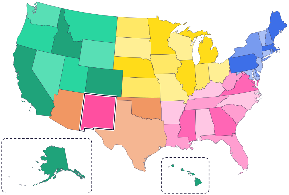
New Mexico is in the Southwest. It touches four states: Arizona to the west, Colorado to the north, Oklahoma to the northeast and Texas to the east and south.
To the south, part of its border is with the country of Mexico. A big river, the Rio Grande, flows south through the state, from Colorado to Texas.
Fun facts
- 1
New Mexico has an official state question: “Red or green?” It asks which kind of chile you want on your food.
- 2
New Mexico was the first state to have an official state cookie: the biscochito, since 1989.
- 3
Smokey Bear was a real black bear cub. He was found hurt after a forest fire in the Lincoln National Forest, near Capitan, New Mexico.
- 4
The state bird, the roadrunner, can fly, but only weakly. It would rather run!
- 5
New Mexico is home to 19 Pueblos, as well as Apache tribes, the Navajo Nation and the Ute Mountain Ute Tribe.
Places to know
White Sands National Park
South-central New Mexico
Giant, wave-like dunes of white gypsum sand cover 275 square miles here. It’s the world’s largest gypsum dunefield.
Carlsbad Caverns National Park
Southeastern New Mexico
More than 119 caves hide under the desert here. From spring to fall, a huge colony of Brazilian free-tailed bats flies out of the cavern every evening.
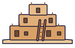
Taos Pueblo
Taos, northern New Mexico
Its adobe homes, up to five stories tall, were built between about 1000 and 1450 AD. Taos Pueblo people still live in the village today.
New Mexico long ago
Ancestral Puebloan people begin building great houses at Chaco Canyon. By 1050, it is the center of the region for ceremonies and trade. Pueblo people today say Chaco was a special gathering place, and it is central to the origins of several Navajo clans.
The Palace of the Governors in Santa Fe dates back to this year. It is still in use today, as a museum.
Congress creates the New Mexico Territory. At first it also includes much of what is now Arizona.
New Mexico joins the Union on January 6, as the 47th state.
The new State Capitol opens in Santa Fe. It’s round, shaped like the Zia sun symbol on the state flag.
State symbols
- State animalBlack bearsince 1963
- State birdRoadrunnersince 1949
- State flowerYuccasince 1927
- State treePiñon pinesince 1949
- State vegetablesChile and frijoles (pinto beans)since 1965
Tricks to remember New Mexico
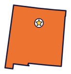
- Almost a square. New Mexico is nearly a square, with a small step sticking down at the bottom left.
- Trace the Rio Grande. The river runs from the top of New Mexico to the bottom, a little west of the middle.
- Santa Fe is up from the middle. Start at the center of New Mexico and head north to reach the capital.
- Look for the sun. The red Zia sun symbol on the yellow flag has four groups of rays. The State Capitol is shaped like it too.
To practice, print a blank US map and color in New Mexico, or find it in the 50 states quiz. Then try today’s mystery state: guess it from its shape, with a clue after each miss.
Teaching all 50? Read how to teach kids the 50 states and what age kids learn the states and capitals, or follow our free 36-week homeschool geography plan.
New Mexico in Map Otter
In Map Otter, kids find New Mexico on the map, learn its capital, and collect its stamp in their passport, with Otto guiding the way. These screenshots show how it looks with a few example states.



Map Otter is coming soon to iPhone, iPad, Android phones and tablets, and Chromebooks.
Questions kids ask
What is the capital of New Mexico?
Santa Fe. Its Palace of the Governors dates back to 1610.
Why is New Mexico called the Land of Enchantment?
The phrase was the title of a book about New Mexico in 1906, and the state’s tourist office used it in the 1930s. It became the official nickname in 1999.
What is the biggest city in New Mexico?
Albuquerque. It’s on the Rio Grande, southwest of Santa Fe.
Is New Mexico part of Mexico?
No. New Mexico is a US state, and has been since 1912. The country of Mexico is its neighbor to the south.
Where these facts come from
- New Mexico Secretary of State: state nickname
- New Mexico Secretary of State: state mammal (black bear)
- New Mexico Secretary of State: state vegetables
- New Mexico Secretary of State: state question
- New Mexico Secretary of State: state cookie
- New Mexico Secretary of State: state bird
- New Mexico Secretary of State: state flower
- New Mexico Secretary of State: state tree
- New Mexico Secretary of State: State Capitol
- New Mexico Secretary of State: state flag
- New Mexico Indian Affairs Department: tribal directory
- National Park Service: Chaco Culture, history and culture
- New Mexico History Museum: Palace of the Governors
- National Park Service: White Sands National Park
- National Park Service: Carlsbad Caverns National Park
- National Park Service: Carlsbad Caverns, bats
- Taos Pueblo: about the Pueblo
- National Archives: New Mexico and Arizona statehood
- Arizona Legislative Council: Arizona Legislative Manual (the New Mexico Territory, 1850)
- US Census Bureau: state area measurements
- US Census Bureau: state population estimates, 2020 to 2025
- US Census Bureau: city and town population estimates, 2020 to 2025
- US Senate Manual: ratification of the Constitution by the 13 original states
- US Senate Manual: states admitted into the Union
- US Census Bureau: census regions and divisions
- NOAA Office for Coastal Management: shoreline mileage of the United States
- Navajo Nation Parks and Recreation: Four Corners Monument
