
Nebraska facts for kids
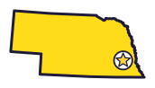
Nebraska is the Cornhusker State (say nuh-BRAS-kuh). Pioneers in covered wagons crossed it, and its Capitol tower in Lincoln is 400 feet tall.
Quick answers
- Where is Nebraska?
- Nebraska is in the Midwest region of the United States. It touches six states: Colorado, Iowa, Kansas, Missouri, South Dakota and Wyoming.
- What is the capital of Nebraska?
- Lincoln. The biggest city is Omaha.
- Does Nebraska touch the ocean?
- No. Nebraska doesn’t touch an ocean or any of the Great Lakes.
- How big is Nebraska?
- 77,348 square miles. It’s the 16th biggest of the 50 states.
Nebraska at a glance
- Capital
- Lincoln
- Nickname
- The Cornhusker State
- Region
- Midwest in Map Otter. The US Census Bureau puts it in the Midwest.
- Became a state
- March 1, 1867, the 37th state
- Biggest city
- Omaha
- Size
- 77,348 square miles, the 16th biggest
- People
- About 2 million (2025), the 38th most
- Neighbors
- Colorado, Iowa, Kansas, Missouri, South Dakota and Wyoming
Where is Nebraska?
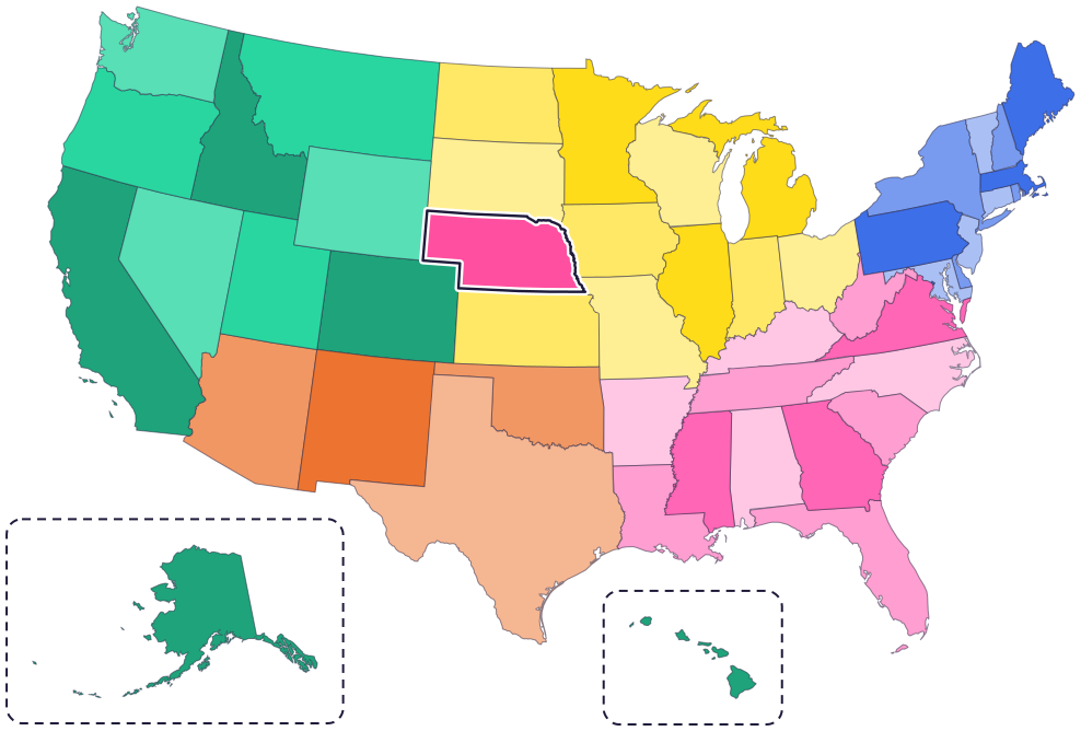
Nebraska is in the Midwest, near the middle of the country. Six states share its borders: South Dakota to the north, Iowa to the east, Missouri to the southeast, Kansas to the south, Colorado to the southwest and Wyoming to the west.
The Missouri River forms its eastern border. The Platte River flows across the state from west to east. The narrow western part of Nebraska is called the Panhandle.
Fun facts
- 1
The Capitol in Lincoln has a tower 400 feet tall. On top stands “The Sower,” a bronze statue 19 feet tall.
- 2
Lincoln was once a small village called Lancaster. It got its new name when it was picked to be the capital.
- 3
Nebraska’s state quarter, from 2006, shows Chimney Rock.
- 4
The western meadowlark is the state bird of Nebraska and five other states.
- 5
Nebraska has a state rock, the prairie agate, and a state gemstone, the blue agate.
Places to know
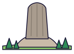
Scotts Bluff National Monument
Gering
The bluff rises 800 feet above the North Platte River. Pioneers on the Oregon, California and Mormon Trails passed it, and you can drive a 1.6-mile road to the top.
Agate Fossil Beds National Monument
Near Harrison
Fossils here come from animals that lived about 20 million years ago, like Dinohyus, nicknamed the “Terrible Pig.” The park also shows Lakota items, like a quilled shirt worn by Chief Red Cloud.
Homestead National Historical Park
Near Beatrice
It tells the story of the Homestead Act of 1862. Step into a one-room schoolhouse and see the oldest restored tallgrass prairie in the national parks.
Nebraska long ago
Ponca people live in big villages near where the Niobrara and Missouri rivers meet, in a homeland that stretches across what is now Nebraska. Today the Ponca Tribe of Nebraska’s main office is in Niobrara.
Thousands of covered wagons on the Oregon, California and Mormon Trails roll past Scotts Bluff.
The Homestead Act invites millions of people to claim land, including families, women, immigrants and formerly enslaved people.
Nebraska becomes a state. Lawmakers move the capital south of the Platte River, to a village named Lancaster that is renamed Lincoln.
After the US government forces the Ponca to move to Indian Territory, in today’s Oklahoma, Ponca chief Standing Bear goes to court. A judge rules, for the first time, that a Native American is a “person” under US law.
Workers build the Capitol in Lincoln, in four phases over ten years.
State symbols
- State mammalWhite-tailed deersince 1981
- State birdWestern meadowlarksince 1929
- State flowerGoldenrodsince 1895
- State treeCottonwoodsince 1972
- State insectHoneybeesince 1975
Tricks to remember Nebraska
- Find the panhandle. The narrow western part sticks out like the handle of a pan.
- River on the right. The Missouri River runs down Nebraska’s whole eastern side.
- Follow the Platte. The Platte River and its branch, the North Platte, cross the state from west to east.
- A president’s name. The capital, Lincoln, is in the southeast part of the state, not far from Omaha.
To practice, print a blank US map and color in Nebraska, or find it in the 50 states quiz. Then try today’s mystery state: guess it from its shape, with a clue after each miss.
Teaching all 50? Read how to teach kids the 50 states and what age kids learn the states and capitals, or follow our free 36-week homeschool geography plan.
Nebraska in Map Otter
In Map Otter, kids find Nebraska on the map, learn its capital, and collect its stamp in their passport, with Otto guiding the way. These screenshots show how it looks with a few example states.



Map Otter is coming soon to iPhone, iPad, Android phones and tablets, and Chromebooks.
Questions kids ask
What is the capital of Nebraska?
Lincoln. It became the capital after Nebraska became a state in 1867. Before that, it was a small village called Lancaster.
What is on top of Nebraska’s Capitol?
“The Sower,” a bronze statue 19 feet tall, at the top of a 400-foot tower.
What is the biggest city in Nebraska?
Omaha, on the Missouri River at the state’s eastern edge.
Who was Standing Bear?
A Ponca chief. In 1879 he went to court, and a judge ruled for the first time that a Native American is a “person” under US law.
Where these facts come from
- Nebraska Secretary of State: state symbols
- Nebraska Capitol Commission: history of the Capitol
- Nebraska Capitol Commission: history of Nebraska’s capitols
- North Dakota Studies (State Historical Society): western meadowlark
- National Park Service: Scotts Bluff National Monument
- National Park Service: Agate Fossil Beds National Monument
- National Park Service: Homestead National Historical Park
- Ponca Tribe of Nebraska: our story
- Nebraska Revised Statutes 90-101: the Cornhusker State
- US Census Bureau: state area measurements
- US Census Bureau: state population estimates, 2020 to 2025
- US Census Bureau: city and town population estimates, 2020 to 2025
- US Senate Manual: ratification of the Constitution by the 13 original states
- US Senate Manual: states admitted into the Union
- US Census Bureau: census regions and divisions
- NOAA Office for Coastal Management: shoreline mileage of the United States
