
Oklahoma facts for kids
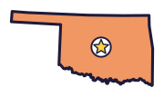
Oklahoma is the Sooner State (say oh-kluh-HOH-muh). On a map, look for its panhandle and for the Red River along much of its bottom edge. Bison live on its prairie, and it even has an official state meal.
Quick answers
- Where is Oklahoma?
- Oklahoma is in the Southwest region of the United States. It touches six states: Arkansas, Colorado, Kansas, Missouri, New Mexico and Texas.
- What is the capital of Oklahoma?
- Oklahoma City. It’s also the biggest city.
- Does Oklahoma touch the ocean?
- No. Oklahoma doesn’t touch an ocean or any of the Great Lakes.
- How big is Oklahoma?
- 69,899 square miles. It’s the 20th biggest of the 50 states.
Oklahoma at a glance
- Capital
- Oklahoma City
- Nickname
- The Sooner State
- Region
- Southwest in Map Otter. The US Census Bureau puts it in the South.
- Became a state
- November 16, 1907, the 46th state
- Biggest city
- Oklahoma City
- Size
- 69,899 square miles, the 20th biggest
- People
- About 4.1 million (2025), the 28th most
- Neighbors
- Arkansas, Colorado, Kansas, Missouri, New Mexico and Texas
Where is Oklahoma?
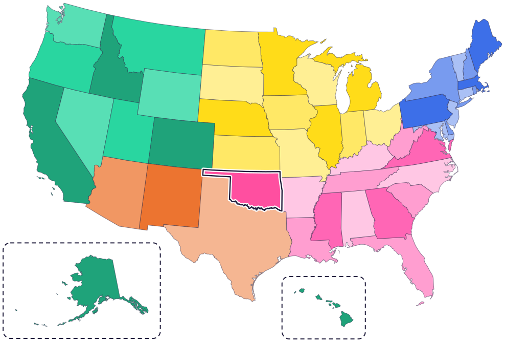
Oklahoma is in the south-central part of the country. It has six neighbor states: Texas to the south and west, New Mexico to the west, Colorado to the northwest, Kansas to the north, Missouri to the northeast and Arkansas to the east.
Along much of its southern edge, the Red River forms its border with Texas. The river cuts through red clay and other rocks, which give its water a reddish color.
Fun facts
- 1
Oklahoma’s official state meal includes chicken-fried steak, fried okra, corn bread, black-eyed peas, strawberries and pecan pie.
- 2
Mistletoe became Oklahoma’s floral emblem in 1893, before Oklahoma was a state. It was the first official floral emblem chosen by any legislature.
- 3
Sequoyah invented a way to write the Cherokee language, with one symbol for each sound: 85 in all. In 1821, he and his daughter, Ahyokah, showed it to the Cherokee Council.
- 4
Oklahoma’s official state pet isn’t one kind of animal. It’s rescue animals!
- 5
Oklahoma City sprang up in a single day: April 22, 1889, the day of the Land Run.
Places to know
Wichita Mountains National Wildlife Refuge
Southwestern Oklahoma
In 1907, a herd of bison arrived here by train from the New York Zoological Park, later the Bronx Zoo. Today you can see bison, longhorns and prairie dogs.
Chickasaw National Recreation Area
Sulphur
More than 30 springs bubble up here, some fresh and some full of minerals. The Chickasaw and Choctaw nations feared losing the springs and asked the US government for help, and in 1906 Congress made the area a national park.
Great Salt Plains
Alfalfa County, northern Oklahoma
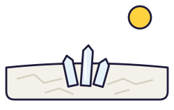
This flat, bare salt flat covers 11,000 acres. A few feet under the surface are selenite crystals shaped like hourglasses: the state crystal.
Oklahoma long ago
Caddoan-speaking people build 12 mounds at Spiro for their leaders. Spiro is part of a trade network that stretches from the Rocky Mountains to the Virginia coast.
The US government forces the Cherokee, Chickasaw, Choctaw, Muscogee (Creek) and Seminole nations to leave their homelands in the Southeast for Indian Territory, now Oklahoma. Many people die on these journeys, called the Trail of Tears. Today all five nations have their homes in Oklahoma.
On April 22 at noon, the Land Run begins. About 50,000 people race to claim land in a two-million-acre area called the Unassigned Lands.
Congress creates Oklahoma Territory, with Guthrie as its capital.
On November 16, Oklahoma Territory and Indian Territory join to become the state of Oklahoma.
Voters pick Oklahoma City as the new capital, in place of Guthrie.
State symbols
- State animalBisonsince 1972
- State birdScissor-tailed flycatchersince 1951
- State flowerOklahoma rosesince 2004
- State treeRedbudsince 1937
- State crystalHourglass selenitesince 2005
Tricks to remember Oklahoma
- A handle on the left. The long, thin strip at the top left of Oklahoma looks like the handle of a pan.
- Oklahoma City is near the middle. Skip the panhandle and look at the big part of the state. The capital is close to its center.
- Follow the Red River. It runs along much of the bottom edge, between Oklahoma and Texas.
- Two territories, one state. Oklahoma was made from two territories joined together: Oklahoma Territory and Indian Territory.
To practice, print a blank US map and color in Oklahoma, or find it in the 50 states quiz. Then try today’s mystery state: guess it from its shape, with a clue after each miss.
Teaching all 50? Read how to teach kids the 50 states and what age kids learn the states and capitals, or follow our free 36-week homeschool geography plan.
Oklahoma in Map Otter
In Map Otter, kids find Oklahoma on the map, learn its capital, and collect its stamp in their passport, with Otto guiding the way. These screenshots show how it looks with a few example states.



Map Otter is coming soon to iPhone, iPad, Android phones and tablets, and Chromebooks.
Questions kids ask
What is the capital of Oklahoma?
Oklahoma City. Voters picked it in 1910. Before that, the capital was Guthrie.
Why is Oklahoma called the Sooner State?
In the Land Run of 1889, “Sooners” were people who sneaked in before the official start time. Later the name became a point of pride. It isn’t an official nickname, but it’s widely used.
What is the biggest city in Oklahoma?
Oklahoma City. It’s also the capital.
What was the Land Run?
A race for land. On April 22, 1889, about 50,000 people waited at the edges of the Unassigned Lands, and at noon they raced in to claim land.
Where these facts come from
- Oklahoma Historical Society: state symbols
- Oklahoma Historical Society: state meal
- Oklahoma Historical Society: mistletoe
- Oklahoma Historical Society: Sooner
- Oklahoma Historical Society: Sequoyah
- Oklahoma Historical Society: Spiro Mounds
- Oklahoma Historical Society: Trail of Tears
- Oklahoma Historical Society: Indian Removal
- Oklahoma Historical Society: Oklahoma City
- Oklahoma Historical Society: Land Run of 1889
- Oklahoma Historical Society: Oklahoma Territory
- Oklahoma Historical Society: statehood movement
- Oklahoma Historical Society: Red River
- Oklahoma Historical Society: Wichita Mountains National Wildlife Refuge
- Oklahoma Historical Society: Chickasaw National Recreation Area
- Oklahoma Historical Society: Great Salt Plains
- Choctaw Nation of Oklahoma: history
- Bureau of Indian Affairs: tribes served by the Eastern Oklahoma Region
- US Census Bureau: state area measurements
- US Census Bureau: state population estimates, 2020 to 2025
- US Census Bureau: city and town population estimates, 2020 to 2025
- US Senate Manual: ratification of the Constitution by the 13 original states
- US Senate Manual: states admitted into the Union
- US Census Bureau: census regions and divisions
- NOAA Office for Coastal Management: shoreline mileage of the United States
