
Arizona facts for kids
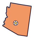
Arizona is the Grand Canyon State (say air-ih-ZOH-nuh), and its canyon is more than a mile deep. Giant cactuses grow here, and Arizona mines more copper than any other state.
Quick answers
- Where is Arizona?
- Arizona is in the Southwest region of the United States. It touches four states: California, Nevada, New Mexico and Utah. It also meets Colorado at a single point, the Four Corners.
- What is the capital of Arizona?
- Phoenix. It’s also the biggest city.
- Does Arizona touch the ocean?
- No. Arizona doesn’t touch an ocean or any of the Great Lakes.
- How big is Arizona?
- 113,990 square miles. It’s the 6th biggest of the 50 states.
Arizona at a glance
- Capital
- Phoenix
- Nickname
- The Grand Canyon State
- Region
- Southwest in Map Otter. The US Census Bureau puts it in the West.
- Became a state
- February 14, 1912, the 48th state
- Biggest city
- Phoenix
- Size
- 113,990 square miles, the 6th biggest
- People
- About 7.6 million (2025), the 14th most
- Neighbors
- California, New Mexico, Nevada and Utah
Where is Arizona?
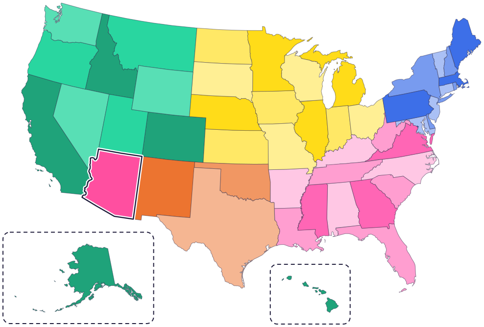
Arizona is in the Southwest. It touches four states: California to the west, Nevada to the northwest, Utah to the north and New Mexico to the east.
To the south is the country of Mexico. On the west side, the Colorado River runs along much of the border with Nevada and California.
Fun facts
- 1
Arizona has mined more copper than any other state for more than 100 years. Copper is its state metal, too.
- 2
Four Corners, at Arizona’s northeast corner, is the only place in the United States where four states meet at one point: Arizona, Colorado, New Mexico and Utah.
- 3
The Navajo Nation’s land, Diné Bikéyah, covers more than 27,000 square miles in Arizona, New Mexico and Utah. That’s bigger than 10 of the 50 states!
- 4
Pluto was discovered in Arizona in 1930, at Lowell Observatory in Flagstaff. In 2024, Arizona made Pluto its official state planet.
- 5
The bola tie is Arizona’s official state neckwear.
Places to know
Grand Canyon National Park
Northern Arizona
The Colorado River carved this canyon. It’s 277 miles long, up to 18 miles wide and, at its deepest, more than a mile deep. The oldest rocks at the bottom are close to 2 billion years old.
Petrified Forest National Park
Northeastern Arizona
Over 200 million years ago, logs washed into a river and were buried. Slowly, minerals turned the wood into colorful stone.
Saguaro National Park
Tucson
Giant saguaro cactuses grow here, and only in the Sonoran Desert. A saguaro can live 150 years or more, and it usually grows its first arms at 60 to 75 years old.
Arizona long ago
Ancestral Sonoran Desert people start digging canals to water their crops. Archeologists have found hundreds of miles of these canals. Today, O’odham, Hopi and Zuni people are among their descendants.
President Abraham Lincoln signs a law that creates the Territory of Arizona from part of the New Mexico Territory.
After moving between Prescott and Tucson, the capital settles in Phoenix.
Arizona joins the Union as the 48th state, on February 14.
The Grand Canyon becomes a national park.
Clyde Tombaugh discovers Pluto at Lowell Observatory in Flagstaff.
State symbols
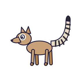
- State mammalRingtailsince 1986
- State birdCactus wrensince 1931
- State flowerSaguaro blossomsince 1931
- State treePalo verdesince 1954
Tricks to remember Arizona
- A box with a slanted corner. Arizona is almost a rectangle, but its bottom left edge slants, and its left side wiggles along the Colorado River.
- Four states, one corner. The top right corner of Arizona is Four Corners, where it meets Utah, Colorado and New Mexico.
- Phoenix sits just below the center. Find the middle of Arizona, then drop down a little to reach the capital.
- The canyon is at the top. The Grand Canyon is in the north of the state, close to the Utah border.
To practice, print a blank US map and color in Arizona, or find it in the 50 states quiz. Then try today’s mystery state: guess it from its shape, with a clue after each miss.
Teaching all 50? Read how to teach kids the 50 states and what age kids learn the states and capitals, or follow our free 36-week homeschool geography plan.
Arizona in Map Otter
In Map Otter, kids find Arizona on the map, learn its capital, and collect its stamp in their passport, with Otto guiding the way. These screenshots show how it looks with a few example states.



Map Otter is coming soon to iPhone, iPad, Android phones and tablets, and Chromebooks.
Questions kids ask
What is the capital of Arizona?
Phoenix. It has been the capital since 1889, when Arizona was still a territory.
Why is Arizona called the Grand Canyon State?
Because the Grand Canyon is in northern Arizona. Arizona made the nickname official in 2011.
What is the biggest city in Arizona?
Phoenix. The capital is the biggest city too.
How old is the Grand Canyon?
The Colorado River carved the canyon in the past 5 or 6 million years. The rocks at the very bottom are much older: close to 2 billion years old.
Where these facts come from
- Arizona Legislature: state nickname (A.R.S. 41-860.01)
- Arizona House of Representatives: summary of 2011 laws (HB 2549, state nickname)
- Arizona State Library: state symbols
- Arizona Legislature: state animals (A.R.S. 41-859)
- Arizona Legislature: state bird (A.R.S. 41-854)
- Arizona Legislature: state neckwear (A.R.S. 41-857)
- Arizona Legislature: state planet (A.R.S. 41-860.08)
- Arizona Senate: fact sheet for HB 2477, state planet (2024)
- Arizona Geological Survey: Arizona and copper
- Arizona Secretary of State: Arizona almanac, state symbols
- Navajo Nation Parks & Recreation: Four Corners Monument
- Navajo Nation: history
- National Park Service: the Ancestral Sonoran Desert people (Casa Grande Ruins)
- National Archives: H.R. 357, the Territory of Arizona
- National Archives: New Mexico and Arizona statehood
- Arizona Legislative Council: Arizona Legislative Manual (history)
- National Park Service: Grand Canyon questions and answers
- National Park Service: Petrified Forest, petrified wood
- National Park Service: Saguaro National Park, the saguaro
- NASA: Clyde Tombaugh
- National Park Service: Southwest river environments (the Colorado River)
- Office of the Arizona Governor: legislative action update, March 2024 (HB 2477, state planet, signed)
- US Census Bureau: state area measurements
- US Census Bureau: state population estimates, 2020 to 2025
- US Census Bureau: city and town population estimates, 2020 to 2025
- US Senate Manual: ratification of the Constitution by the 13 original states
- US Senate Manual: states admitted into the Union
- US Census Bureau: census regions and divisions
- NOAA Office for Coastal Management: shoreline mileage of the United States
- Navajo Nation Parks and Recreation: Four Corners Monument
