
Alaska facts for kids
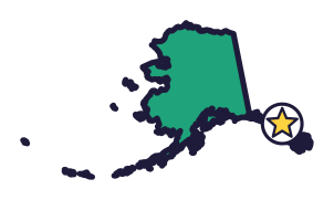
Alaska, the Last Frontier (say uh-LAS-kuh), is the biggest state. The United States bought it from Russia in 1867, and North America’s tallest peak stands here.
Quick answers
- Where is Alaska?
- Alaska is in the far northwest of North America, in the West region. It doesn’t touch any other state: Canada is to the east.
- What is the capital of Alaska?
- Juneau. The biggest city is Anchorage.
- Does Alaska touch the ocean?
- Yes: the Pacific Ocean to the south and west, and the Arctic Ocean to the north.
- How big is Alaska?
- 665,384 square miles. It’s the biggest state.
Alaska at a glance
- Capital
- Juneau
- Nickname
- The Last Frontier
- Region
- West in Map Otter. The US Census Bureau puts it in the West.
- Became a state
- January 3, 1959, the 49th state
- Biggest city
- Anchorage
- Size
- 665,384 square miles, the biggest state
- People
- About 740,000 (2025), the 48th most
- Neighbors
- No other states. Its neighbor is the country of Canada.
Where is Alaska?
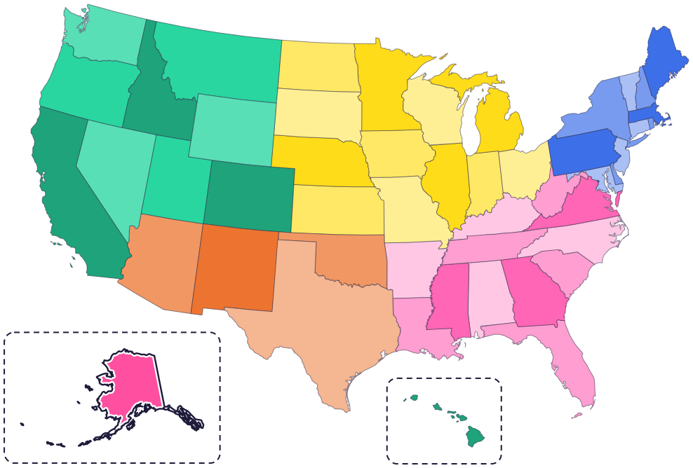
Alaska is in the far northwest of North America. It doesn’t touch any other state: Canada lies between Alaska and the rest of the country, and it borders Alaska to the east.
The Arctic Ocean is to the north and the Pacific Ocean is to the south. To the west, across the Bering Strait, is Russia. Because it’s so far away, Map Otter’s map shows Alaska in a box at the bottom left.
Fun facts
- 1
The United States bought Alaska from Russia for $7.2 million. That’s less than 2 cents an acre!
- 2
Alaska is home to 229 federally recognized tribes.
- 3
The king salmon, Alaska’s state fish, is the biggest of all Pacific salmon. The record one weighed 126 pounds.
- 4
Bowhead whales use their thick, padded heads to break through ice, so they can breathe. They may live 150 to 200 years.
- 5
About 175,000 to 200,000 moose live in Alaska. Alaska’s moose are the biggest kind of moose, and they can stand almost 6 feet tall.
Places to know
Denali National Park and Preserve
Interior Alaska
Six million acres of wild land, with just one road through it. North America’s tallest peak, 20,310 feet high, rises here. In winter, rangers patrol with sled dog teams.
Glacier Bay National Park
Southeast Alaska
Icebergs break off glaciers that reach the sea and float in the bay. It’s the homeland of the Huna and Yakutat Lingít (Tlingit) people.
Sitka National Historical Park
Sitka
Eighteen totem poles from Tlingit and Haida areas line the park’s trail along the coast. The park also protects the site of a battle between invading Russian traders and Kiks.ádi Tlingit people.
Alaska long ago
The heritage of Tlingit people in Sitka, in southeast Alaska, goes back more than 10,000 years. Tlingit culture is still alive there today.
On March 30, the United States agrees to buy Alaska from Russia for $7.2 million.
Benny Benson, 13 years old, wins a contest to design a flag for the Territory of Alaska.
On July 7, President Eisenhower signs the Alaska Statehood Act.
Alaska joins the Union on January 3, as the 49th state.
State symbols
- State land mammalMoosesince 1998
- State birdWillow ptarmigansince 1955
- State fishKing (Chinook) salmonsince 1963
- Alaska’s flagEight gold stars, by Benny Bensonsince 1927
Tricks to remember Alaska
- Look in the box at the bottom left. On Map Otter’s map, Alaska sits in its own box, because it’s far to the northwest, past Canada.
- Find the tail and the handle. A long chain of islands trails off to the southwest like a tail, and a thin strip called the panhandle runs down the southeast, next to Canada.
- Juneau is in the panhandle. The capital isn’t in the big main part of Alaska. Look for it in the thin strip at the bottom right.
- Eight gold stars. Alaska’s flag has eight gold stars on it, and a 13-year-old designed it.
To practice, print a blank US map and color in Alaska, or find it in the 50 states quiz. Then try today’s mystery state: guess it from its shape, with a clue after each miss.
Teaching all 50? Read how to teach kids the 50 states and what age kids learn the states and capitals, or follow our free 36-week homeschool geography plan.
Alaska in Map Otter
In Map Otter, kids find Alaska on the map, learn its capital, and collect its stamp in their passport, with Otto guiding the way. These screenshots show how it looks with a few example states.



Map Otter is coming soon to iPhone, iPad, Android phones and tablets, and Chromebooks.
Questions kids ask
What is the capital of Alaska?
Juneau. It’s in the panhandle, the thin strip of Alaska in the southeast, next to Canada.
Is Alaska the biggest state?
Yes. Alaska is the biggest state. Texas is second.
What is the biggest city in Alaska?
Anchorage. It isn’t the capital: that’s Juneau.
Why is Alaska in a box on the map?
Alaska is far to the northwest, with Canada between it and the other states. Showing it in a box at the bottom left lets it fit on the same map.
Where these facts come from
- National Archives: check for the purchase of Alaska
- National Park Service: Sitka National Historical Park
- Eisenhower Presidential Library: Alaska statehood
- Alaska State Museum: Eight Stars of Gold, the story of Alaska’s flag
- Bureau of Indian Affairs: Alaska Region
- Alaska Department of Fish and Game: Chinook salmon
- Alaska Department of Fish and Game: moose
- Alaska Department of Fish and Game: bowhead whale (Wildlife Notebook)
- National Park Service: Denali National Park and Preserve
- National Park Service: Glacier Bay National Park and Preserve
- Alaska Legislature: the moose as state land mammal (1998, AS 44.09.078)
- US Census Bureau: state area
- Alaska Legislature: act naming the willow ptarmigan the official bird (Session Laws 1955, chapter 1)
- Alaska State Museum: Eight Stars of Gold, exhibit catalog
- US Census Bureau: state population estimates, 2020 to 2025
- US Census Bureau: city and town population estimates, 2020 to 2025
- US Senate Manual: ratification of the Constitution by the 13 original states
- US Senate Manual: states admitted into the Union
- US Census Bureau: census regions and divisions
- NOAA Office for Coastal Management: shoreline mileage of the United States
