
Oregon facts for kids
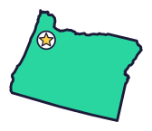

Oregon (say OR-ih-guhn) is the Beaver State, and it became a state on Valentine’s Day. It has the deepest lake in the country and some of the oldest known shoes.
Quick answers
- Where is Oregon?
- Oregon is in the West region of the United States. It touches four states: California, Idaho, Nevada and Washington.
- What is the capital of Oregon?
- Salem. The biggest city is Portland.
- Does Oregon touch the ocean?
- Yes. Oregon has a coast on the Pacific Ocean.
- How big is Oregon?
- 98,379 square miles. It’s the 9th biggest of the 50 states.
Oregon at a glance
- Capital
- Salem
- Nickname
- The Beaver State
- Region
- West in Map Otter. The US Census Bureau puts it in the West.
- Became a state
- February 14, 1859, the 33rd state
- Biggest city
- Portland
- Size
- 98,379 square miles, the 9th biggest
- People
- About 4.3 million (2025), the 27th most
- Neighbors
- California, Idaho, Nevada and Washington
Where is Oregon?
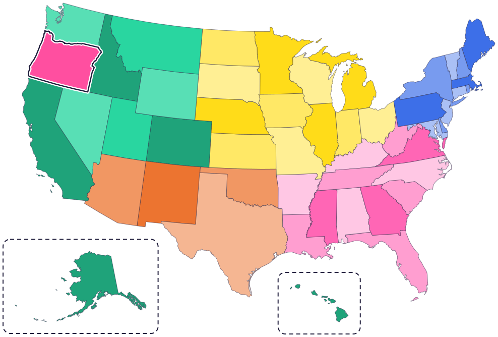
Oregon is in the Pacific Northwest. It touches four states: Washington to the north, Idaho to the east, Nevada to the southeast and California to the south.
To the west is the Pacific Ocean. The Columbia River forms much of the border with Washington, and the Snake River forms part of the border with Idaho, deep in Hells Canyon.
Fun facts
- 1
Sandals made of sagebrush and bark were found in Fort Rock Cave. They’re about 9,300 years old, some of the oldest known shoes!
- 2
Oregon’s flag has a different picture on each side. The back shows a beaver.
- 3
A fourth-grade class in West Linn asked for a state crustacean. In 2009, lawmakers named the Dungeness crab.
- 4
Hells Canyon, on the border with Idaho, is the deepest gorge in North America. In places it’s 7,913 feet deep.
- 5
Multnomah Falls is Oregon’s highest waterfall. It drops 620 feet.
Places to know
Crater Lake National Park
Southern Oregon
The deepest lake in the US, 1,943 feet deep. It formed about 7,700 years ago, when a huge eruption made a tall volcano collapse. Rain and snow fill it.
John Day Fossil Beds
Near Kimberly, Mitchell and Fossil
Fossils here show dog-sized, three-toed horses and rhino-like animals called brontotheres. The Painted Hills are made of ancient soils turned to stone.

Fort Clatsop
Near Astoria
The Lewis and Clark expedition built Fort Clatsop in 1805, after exploring the Snake and Columbia Rivers. Today you can visit a copy of the wooden fort, 50 feet on each side.
Oregon long ago
People live at Paisley Caves in south-central Oregon. Many tribal oral histories say Native people have lived in Oregon since time immemorial.
Mount Mazama erupts and Crater Lake forms. Oral history and archaeology suggest ancestors of the Klamath Tribes saw it. The Klamath Tribes, the Klamath, Modoc and Yahooskin-Paiute peoples, have lived in the Klamath Basin “from time beyond memory.”
The Lewis and Clark expedition explores the Snake and Columbia Rivers and builds Fort Clatsop.
The first large group of settlers, more than 900 people, arrives on the Oregon Trail.
The Umatilla, Nez Perce, Warm Springs and Walla Walla tribes sign treaties with the United States that keep some of their land and their rights to food sources.
On February 14, Valentine’s Day, Oregon becomes a state. It had been a territory since 1848.
State symbols
- State animalBeaversince 1969
- State birdWestern meadowlarksince 1927
- State flowerOregon grapesince 1899
- State treeDouglas firsince 1939
- State rockThunder eggsince 1965
Tricks to remember Oregon
- Say it like an Oregonian. It’s OR-ih-guhn, not or-ee-GONE.
- The Columbia is on top. The Columbia River runs along most of Oregon’s top edge, between Oregon and Washington.
- A Valentine state. Oregon became a state on February 14, so its birthday is Valentine’s Day.
- Salem is up and to the left. The capital is in the northwest part of the state, south of Portland.
To practice, print a blank US map and color in Oregon, or find it in the 50 states quiz. Then try today’s mystery state: guess it from its shape, with a clue after each miss.
Teaching all 50? Read how to teach kids the 50 states and what age kids learn the states and capitals, or follow our free 36-week homeschool geography plan.
Oregon in Map Otter
In Map Otter, kids find Oregon on the map, learn its capital, and collect its stamp in their passport, with Otto guiding the way. These screenshots show how it looks with a few example states.



Map Otter is coming soon to iPhone, iPad, Android phones and tablets, and Chromebooks.
Questions kids ask
What is the capital of Oregon?
Salem. It became the capital of Oregon Territory in 1852 and the state capital in 1864.
Why is Oregon called the Beaver State?
The beaver is Oregon’s state animal, and a beaver is on the back of the state flag.
What is the biggest city in Oregon?
Portland. Next come Salem, the capital, and Eugene.
How deep is Crater Lake?
1,943 feet. It’s the deepest lake in the United States.
Where these facts come from
- Oregon Blue Book: almanac, A to C
- Oregon Blue Book: almanac, D to H
- Oregon Blue Book: almanac, H to M
- Oregon Blue Book: almanac, N to S
- Oregon Blue Book: almanac, S to W
- Oregon Blue Book: Oregon prehistory
- Oregon Blue Book: Oregon history, 1543 to 1850
- Oregon Blue Book: Oregon history, 1851 to 1900
- The Klamath Tribes: history
- National Park Service: Crater Lake
- National Park Service: John Day Fossil Beds
- National Park Service: Lewis and Clark National Historical Park
- Oregon Blue Book: almanac, M to N
- US Census Bureau: state area measurements
- US Census Bureau: state population estimates, 2020 to 2025
- US Census Bureau: city and town population estimates, 2020 to 2025
- US Senate Manual: ratification of the Constitution by the 13 original states
- US Senate Manual: states admitted into the Union
- US Census Bureau: census regions and divisions
- NOAA Office for Coastal Management: shoreline mileage of the United States
