
Idaho facts for kids
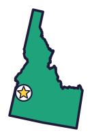

Idaho is the Gem State (say EYE-duh-hoh), with rare star garnets and spotted Appaloosa horses. Astronauts once explored its lava fields.
Quick answers
- Where is Idaho?
- Idaho is in the West region of the United States. It touches six states: Montana, Nevada, Oregon, Utah, Washington and Wyoming.
- What is the capital of Idaho?
- Boise. It’s also the biggest city.
- Does Idaho touch the ocean?
- No. Idaho doesn’t touch an ocean or any of the Great Lakes.
- How big is Idaho?
- 83,569 square miles. It’s the 14th biggest of the 50 states.
Idaho at a glance
- Capital
- Boise
- Nickname
- The Gem State
- Region
- West in Map Otter. The US Census Bureau puts it in the West.
- Became a state
- July 3, 1890, the 43rd state
- Biggest city
- Boise
- Size
- 83,569 square miles, the 14th biggest
- People
- About 2 million (2025), the 37th most
- Neighbors
- Montana, Nevada, Oregon, Utah, Washington and Wyoming
Where is Idaho?
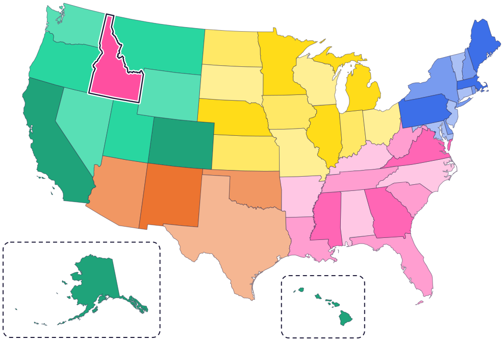
Idaho is in the West, in the Rocky Mountain region. Its six neighbors are Washington and Oregon to the west, Nevada and Utah to the south, Wyoming to the east and Montana to the east and northeast.
To the north, Idaho’s narrow top, called the Panhandle, touches Canada (the province of British Columbia). The Snake River forms part of its border with Oregon and Washington.
Fun facts
- 1
Star garnets, Idaho’s state gem, are found almost only in Idaho and India. The star usually has four points, but sometimes it has six.
- 2
Emma Edwards Green designed Idaho’s state seal. She is the only woman in the US to design a state seal.
- 3
Idaho students, teachers and scientists helped make Oryctodromeus, or “Orycto,” the state dinosaur in 2023.
- 4
The Nez Perce people bred the spotted Appaloosa horse. No two Appaloosas look alike!
- 5
Borah Peak, Idaho’s highest point, is 12,662 feet tall, well over two miles.
Places to know
Craters of the Moon
South-central Idaho
Idaho’s most recent volcanic eruption made a lava flow here about 2,100 years ago. In 1969, astronauts explored the park while training to go to the Moon.
Hagerman Fossil Beds
Southern Idaho
Fossils here are about 3 to 4 million years old. The park has the world’s largest group of fossils of the Hagerman horse, Idaho’s state fossil.
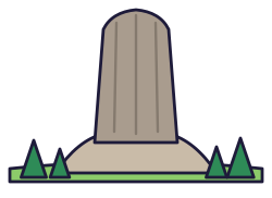
City of Rocks
Southern Idaho, near Almo
Pioneers on the California Trail wrote their names on these granite rocks in axle grease, and you can still see them. One of the Twin Sisters rocks is about 2.5 billion years old.
Idaho long ago
Nimiipuu (Nez Perce) people live in parts of what are now Idaho, Oregon and Washington. Today the Nez Perce Tribe’s headquarters is in Lapwai, Idaho.
Shoshone and Bannock people build rock rings at Indian Tunnel, in what is now Craters of the Moon. Each fall they gather pine nuts at City of Rocks, and members of the Fort Hall Reservation still do.
In September, the Lewis and Clark expedition crosses the Bitterroot Mountains. On Weippe Prairie, Nez Perce people accept the strangers onto their land, trade gifts with them and share information about the country.
Nearly 250,000 travelers heading for California pass through City of Rocks. Some write their names on the rocks.
On July 3, Idaho becomes a state.
State symbols
- State horseAppaloosasince 1975
- State birdMountain bluebirdsince 1931
- State flowerSyringasince 1931
- State fishCutthroat troutsince 1990
- State dinosaurOryctodromeussince 2023
Tricks to remember Idaho
- Find the Panhandle. Idaho’s skinny top reaches all the way up to Canada, like the handle of a pan.
- Boise is in the southwest. The capital is in the lower left part of the state, not far from Oregon.
- Zigzag on the right, straight on the bottom. Idaho’s border with Montana zigzags along mountain ridges, but its bottom edge is a straight line.
- Gems and potatoes. Think of Idaho’s two famous treasures: star garnets (the Gem State) and potatoes (the state vegetable).
To practice, print a blank US map and color in Idaho, or find it in the 50 states quiz. Then try today’s mystery state: guess it from its shape, with a clue after each miss.
Teaching all 50? Read how to teach kids the 50 states and what age kids learn the states and capitals, or follow our free 36-week homeschool geography plan.
Idaho in Map Otter
In Map Otter, kids find Idaho on the map, learn its capital, and collect its stamp in their passport, with Otto guiding the way. These screenshots show how it looks with a few example states.



Map Otter is coming soon to iPhone, iPad, Android phones and tablets, and Chromebooks.
Questions kids ask
What is the capital of Idaho?
Boise (say BOY-see), in the southwest part of the state, not far from Oregon.
Why is Idaho called the Gem State?
Idaho produces 72 kinds of precious and semi-precious stones, and some are found nowhere else in the world. One of them is the star garnet, Idaho’s state gem.
What is the biggest city in Idaho?
Boise, the capital. Next come Meridian and Nampa.
Does Idaho really grow lots of potatoes?
Yes. The potato is Idaho’s state vegetable. Idaho’s volcanic soil, warm days, cool nights and snowmelt from the mountains give it nearly perfect growing conditions.
Where these facts come from
- Idaho Secretary of State: state emblems
- Idaho Code 67-4506: state horse
- Visit Idaho: state emblems
- Visit Idaho: about Idaho
- Nez Perce Tribe: history
- Nez Perce Tribe: about
- National Park Service: Weippe Prairie
- National Park Service: City of Rocks
- National Park Service: City of Rocks history and culture
- National Park Service: Craters of the Moon timeline
- National Park Service: Hagerman Fossil Beds fossils
- US Census Bureau: state area measurements
- US Census Bureau: state population estimates, 2020 to 2025
- US Census Bureau: city and town population estimates, 2020 to 2025
- US Senate Manual: ratification of the Constitution by the 13 original states
- US Senate Manual: states admitted into the Union
- US Census Bureau: census regions and divisions
- NOAA Office for Coastal Management: shoreline mileage of the United States
