
A free homeschool geography plan

This is a whole school year of geography, about 15 minutes a day, 4 days a week. Kids start with maps and the continents, learn the 50 states a region at a time, then the capitals, and end the year with the world. Everything it uses is free on this site.
A week, day by day
- Day 1, learn: read the week’s page together and look at the map.
- Day 2, play: a round of the week’s game.
- Day 3, print: color, label or fill in the week’s printable.
- Day 4, check: play the game again. If it’s easy, move on; if not, stay another week.
Go at your kid’s pace. A week that takes two is fine, and so is skipping ahead.
Term 1: maps and your place
What a map is. Find north, south, east and west, and read a map key.
Read or print: Map skills
Scale and grids. Measure a distance with a bar scale; find a square on a grid map.
Read or print: Map skills
The 7 continents. Name and point to all seven.
Play: Continents and oceans · Read or print: Continents and oceans
The 5 oceans. Name and point to all five on the map.
Play: Continents and oceans · Read or print: Continents and oceans
The United States on the map. Find the US on a world map; color the 50 states on a blank map.
Play: 50 states quiz · Read or print: Blank US maps
Your home state. Its shape, capital and neighbors.
Play: 50 states quiz · Read or print: Your state’s page
The five regions. Color the regions map; say which one you live in.
Play: 50 states quiz · Read or print: US regions
Your home region. Read your region’s list, then play the map quiz on Find it and spot its states.
Play: 50 states quiz · Read or print: US regions
Review. Map skills, continents, oceans, your region.
Play: Continents and oceans · Read or print: Free printables
Term 2: the 50 states, one region at a time
The Northeast. Learn its 11 states from the regions page, then play the map quiz on Find it and see how many of them you get.
Play: 50 states quiz · Read or print: US regions
The Southeast. Same routine with the Southeast’s 12 states: the regions page first, then Find it on the map quiz.
Play: 50 states quiz · Read or print: US regions
The Midwest. The Midwest’s 12 states, from the regions page. Then try Find it on the map quiz.
Play: 50 states quiz · Read or print: US regions
The Southwest. Only 4 states this week. Learn them from the regions page and find them on the map quiz.
Play: 50 states quiz · Read or print: US regions
The West. Learn the West’s 11 states from the regions page, then play Find it on the map quiz and count how many you get right.
Play: 50 states quiz · Read or print: US regions
All 50 states. Find all 50 on the map quiz.
Play: 50 states quiz · Read or print: Blank US maps
Term 3: capitals and more
Capitals: the freebies. Learn the capitals that give you a head start, and the big-city trap.
Play: State capitals quiz · Read or print: How to memorize them
Capitals: Northeast. Learn its 11 capitals from the list on the capitals quiz page, then play and see how many you get.
Play: State capitals quiz · Read or print: How to memorize them
Capitals: Southeast. Learn the 12 Southeast capitals from the list on the capitals quiz page, then play.
Play: State capitals quiz · Read or print: How to memorize them
Capitals: Midwest. Same again for the Midwest’s 12 capitals: the list on the capitals quiz page, then the quiz.
Play: State capitals quiz · Read or print: How to memorize them
Capitals: Southwest and West. Two regions at once: 15 capitals, from the list on the capitals quiz page. Then play.
Play: State capitals quiz · Read or print: How to memorize them
All 50 capitals. Pick it, then Match it, then Type it.
Play: State capitals quiz · Read or print: Blank US maps
State abbreviations. The two-letter code for each state.
Read or print: State abbreviations
State shapes. Name a state from its shape.
Play: Mystery state · Read or print: How to memorize them
Term 4: the world
Flags of North and South America. Name the flags of the Americas.
Play: Flags of the world · Read or print: Flags of the world
Flags of Europe. Name 10 flags of Europe.
Play: Flags of the world · Read or print: Flags of the world
Flags of Africa. Name 10 flags of Africa.
Play: Flags of the world · Read or print: Flags of the world
Flags of Asia. Name 10 flags of Asia.
Play: Flags of the world · Read or print: Flags of the world
Australia and Oceania. Name its flags; read about Australia.
Play: Flags of the world · Read or print: Australia
Neighbors: Canada. Its provinces and territories, and its capital.
Read or print: Canada
Latitude and longitude. Find a place from its coordinates.
Read or print: Latitude and longitude
The year in review. One round of every game.
Play: Games · Read or print: Free printables
Print the checklist
-
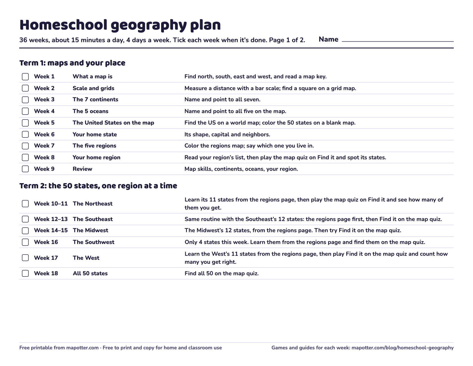
Homeschool geography plan
A 36-week checklist: a goal for every week, from map skills to the 50 states and capitals to flags of the world.
PDF · 2 pages · 67 KB · US Letter, landscape
Download the homeschool geography plan PDF
Younger or older kids
- Ages 5 to 7: stay with Term 1 for longer, and color more than you quiz. Our guide on what age kids learn the states says what schools expect in the early grades.
- Ages 11 to 13: go faster through Terms 1 and 2, use “Type it” in the capitals quiz, and add latitude and longitude and the rivers and mountains early.
Teaching more than one kid
Play the same game at different levels: the younger kid on “Find it” with 10 questions, the older one on “Name it” with all 50. Then switch and let the older one quiz the younger with the flashcards.
Homeschool with Map Otter
Map Otter is built for this too. Up to five kids can share one device, each with their own progress and their own track, and Family Challenge lets everyone play together. It works offline, has a daily time limit if you want one, and kids earn certificates you can print.
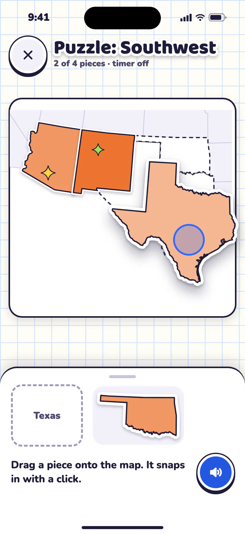


Free to try, for one kid: your home state, your home region’s games, Road Trip’s first chapter, Map Skills and the Daily Mystery. No ads, no tracking, no accounts.
Map Otter is coming soon to iPhone, iPad, Android phones and tablets, and Chromebooks.
