
The regions of the United States


One way to split the United States is into five regions: the Northeast, the Southeast, the Midwest, the Southwest and the West. It’s the way our app, Map Otter, does it. Learning the states one region at a time is easier than learning all 50 at once. Here are the five regions, the states in each, and a regions map to print.
The five regions and their states
Big cities, rocky coasts and the smallest states.
Connecticut, Delaware, Maine, Maryland, Massachusetts, New Hampshire, New Jersey, New York, Pennsylvania, Rhode Island, Vermont. Washington, D.C., the nation’s capital, is here too.
Warm weather, sandy beaches, swamps and the Appalachian Mountains.
Alabama, Arkansas, Florida, Georgia, Kentucky, Louisiana, Mississippi, North Carolina, South Carolina, Tennessee, Virginia, West Virginia.
Deserts, canyons and wide open skies.
Print the regions map
-
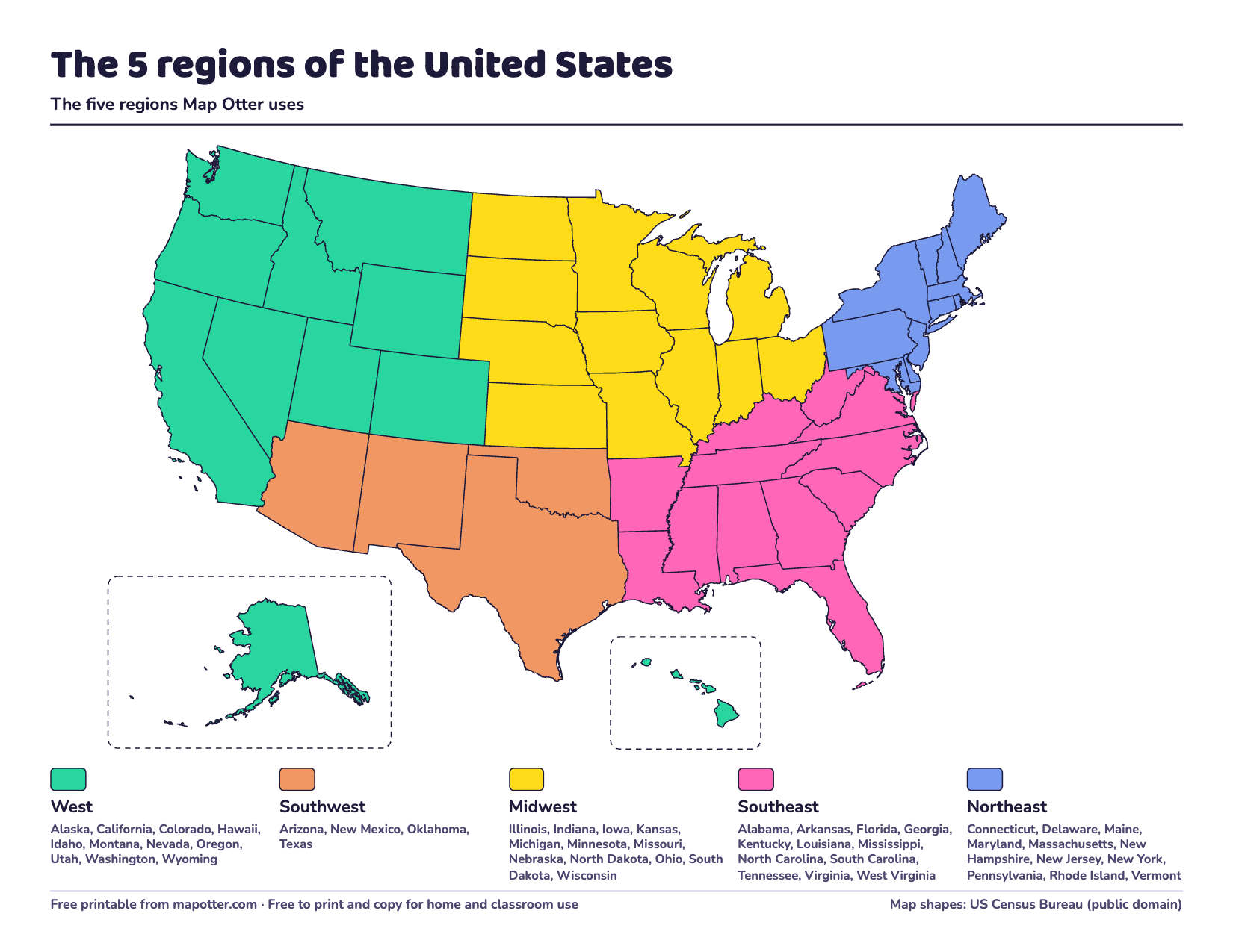
US regions map
The five regions in color with every state listed, and a version to color in yourself.
PDF · 2 pages · 124 KB · US Letter, landscape
Download the US regions map PDF
The second page is the same map with no colors: kids pick a color for each region, fill in its box, then color its states.
Four regions or five?
Not everyone splits the country the same way. The US Census Bureau uses four regions: the Northeast, the Midwest, the South and the West. Map Otter uses five, adding a Southwest. The only differences:
- The Census Bureau’s South includes Texas, Oklahoma, Delaware, Maryland and Washington, D.C.
- Arizona and New Mexico are in the Census Bureau’s West.
Neither is wrong: they’re ways of grouping. If your kid’s class uses a different map, use theirs.
How to learn the regions
- Start with your own region. Find your state, then the other states in its region.
- Color them in. Coloring the blank regions map is a good first step for younger kids.
- One region a week. Five weeks covers the whole country.
- Name a feature for each. The Great Lakes for the Midwest, deserts for the Southwest, the Pacific coast for the West.
For more, read how to teach kids the 50 states, or print our blank US maps.
How Map Otter helps
Map Otter’s Road Trips go region by region, and each region has the same color it has on the printable map. It’s a geography app we’re making for kids 4 to 13, coming soon to iPhone, iPad, Android and Chromebooks, and it has no ads, no tracking and no accounts.
