
North Carolina facts for kids
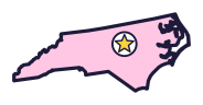

North Carolina is the Tar Heel State (say north kair-uh-LY-nuh). The first airplane flights took off from its coast, where long thin islands line the shore. It also has the highest point east of the Mississippi River.
Quick answers
- Where is North Carolina?
- North Carolina is in the Southeast region of the United States. It touches four states: Georgia, South Carolina, Tennessee and Virginia.
- What is the capital of North Carolina?
- Raleigh. The biggest city is Charlotte.
- Does North Carolina touch the ocean?
- Yes. North Carolina has a coast on the Atlantic Ocean.
- How big is North Carolina?
- 53,819 square miles. It’s the 28th biggest of the 50 states.
North Carolina at a glance
- Capital
- Raleigh
- Nickname
- The Tar Heel State
- Region
- Southeast in Map Otter. The US Census Bureau puts it in the South.
- Became a state
- November 21, 1789, one of the 13 original states (the 12th to approve the Constitution)
- Biggest city
- Charlotte
- Size
- 53,819 square miles, the 28th biggest
- People
- About 11.2 million (2025), the 9th most
- Neighbors
- Georgia, South Carolina, Tennessee and Virginia
Where is North Carolina?
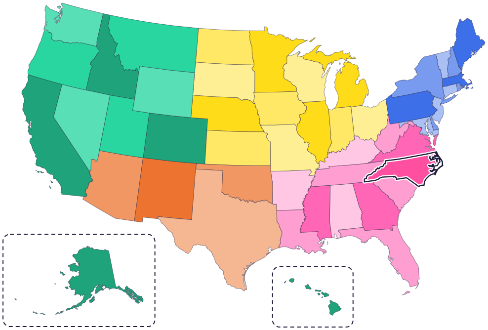
North Carolina is in the southeastern part of the country, on the Atlantic coast. It has four neighbor states: Virginia to the north, Tennessee to the west, Georgia to the southwest and South Carolina to the south.
To the east is the Atlantic Ocean. Along the coast are the Outer Banks, a long chain of thin islands. In the west are the Appalachian Mountains, including the Blue Ridge and the Great Smoky Mountains.
Fun facts
- 1
The Venus flytrap is North Carolina’s state carnivorous plant. It grows wild in parts of North and South Carolina, and its leaves close like a trap to catch ants, spiders and beetles.
- 2
North Carolina’s state fossil is the fossilized teeth of the megalodon, a giant shark from long ago.
- 3
The state marsupial is the Virginia opossum, even though it’s named for another state.
- 4
In the 1700s, North Carolina was a world leader in making tar, pitch and rosin from pine trees. Ships used tar to seal their hulls.
- 5
At 6,684 feet, Mount Mitchell is the highest point east of the Mississippi River.
Places to know
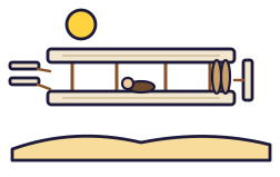
Wright Brothers National Memorial
Near Kitty Hawk, on the Outer Banks
On December 17, 1903, Orville and Wilbur Wright made the first successful airplane flights here. A boulder marks the spot where they took off, and you can walk the flight line.
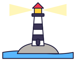
Cape Hatteras Lighthouse
Cape Hatteras, on the Outer Banks
The tallest brick lighthouse in the United States, with famous black-and-white stripes. In 1999, the whole lighthouse was moved 2,900 feet to keep it safe from the ocean.

Blue Ridge Parkway
The mountains of western North Carolina
This road winds for 469 miles through North Carolina and Virginia, with long views of the rugged mountains of the Appalachian Highlands.
North Carolina long ago
John White leads 117 English men, women and children to the New World. When he returns to Roanoke Island three years later, the colony has disappeared. It’s known as the Lost Colony.
On November 21, North Carolina approves the US Constitution and becomes the 12th state. It waited until Congress had proposed a Bill of Rights.
US Army troops and state militias force more than 16,000 Cherokee people from their homes in North Carolina and nearby states and send them west, on the Trail of Tears. A small group in western North Carolina is allowed to stay. Today the Eastern Band of Cherokee Indians’ home is the Qualla Boundary, in western North Carolina.
On December 17, the Wright brothers make the first successful airplane flights, near Kitty Hawk.
Four freshmen from North Carolina A&T start a sit-in at the Woolworth lunch counter in Greensboro. It sparks similar protests across the country during the civil rights movement.
State symbols
- State mammalGray squirrelsince 1969
- State birdCardinalsince 1943
- State flowerDogwoodsince 1941
- State carnivorous plantVenus flytrapsince 2005
- State vegetableSweet potatosince 1995
Tricks to remember North Carolina
- North is on top. North Carolina sits right on top of South Carolina.
- Mountains on the left, beaches on the right. The mountains are in the west, and the Outer Banks line the east coast.
- Find the elbow. Along the coast, the Outer Banks bend out into the ocean at Cape Hatteras, like an elbow.
- Raleigh leans east. The capital is a little to the right of the middle of the state, toward the coast.
To practice, print a blank US map and color in North Carolina, or find it in the 50 states quiz. Then try today’s mystery state: guess it from its shape, with a clue after each miss.
Teaching all 50? Read how to teach kids the 50 states and what age kids learn the states and capitals, or follow our free 36-week homeschool geography plan.
North Carolina in Map Otter
In Map Otter, kids find North Carolina on the map, learn its capital, and collect its stamp in their passport, with Otto guiding the way. These screenshots show how it looks with a few example states.



Map Otter is coming soon to iPhone, iPad, Android phones and tablets, and Chromebooks.
Questions kids ask
What is the capital of North Carolina?
Raleigh, a little east of the middle of the state.
Why is North Carolina called the Tar Heel State?
No one is sure. Some stories go back to colonial times, and many trace the name to North Carolina’s soldiers in the Civil War. Long before the war, the state was a world leader in making tar from its pine trees.
Where did the first airplane flights happen?
Near Kitty Hawk, on North Carolina’s Outer Banks. On December 17, 1903, Orville Wright flew about 120 feet, and later that day Wilbur flew 852 feet.
What is the biggest city in North Carolina?
Charlotte.
Where these facts come from
- North Carolina General Statutes, Chapter 145: state symbols (Public.Resource.Org copy of the official code)
- US Fish and Wildlife Service: Venus flytrap
- National Park Service: naval stores in North Carolina
- North Carolina State Parks: Mount Mitchell State Park
- National Park Service: Wright Brothers National Memorial
- National Park Service: the first flight
- National Park Service: Cape Hatteras Lighthouse
- National Park Service: moving the Cape Hatteras Lighthouse
- National Park Service: Blue Ridge Parkway
- National Park Service: the Lost Colony
- National Archives: ratifying the Constitution
- National Park Service: Trail of Tears history
- National Park Service: the Cherokee and the Smokies
- North Carolina A&T State University: history and traditions
- North Carolina Department of Natural and Cultural Resources: the Civil War origins of “Tar Heel”
- US Senate Manual: ratification of the Constitution by the 13 original states
- US Census Bureau: state area measurements
- US Census Bureau: state population estimates, 2020 to 2025
- US Census Bureau: city and town population estimates, 2020 to 2025
- US Senate Manual: states admitted into the Union
- US Census Bureau: census regions and divisions
- NOAA Office for Coastal Management: shoreline mileage of the United States
