
How to teach kids the 50 states
Fifty states is a lot to learn, and kids don’t have to learn them all at once. A few minutes on most days works better. Start close to home, go one region at a time, and have kids answer from memory instead of rereading a map. Below is how to do each, and what to expect at each age.
1. Start at home
Kids learn new places by hooking them onto places they already know. So begin with your own state. Find it on a map, trace its outline with a finger, and talk about places in it you’ve been to.
Then add its neighbors. A kid in Ohio meets Michigan, Indiana, Kentucky, West Virginia and Pennsylvania. That’s six states already, and every new state has a neighbor to hook onto.
Family helps too. “Grandma lives here” or “we drove through here” is a stronger memory than any flashcard.
2. Learn in regions, not A to Z
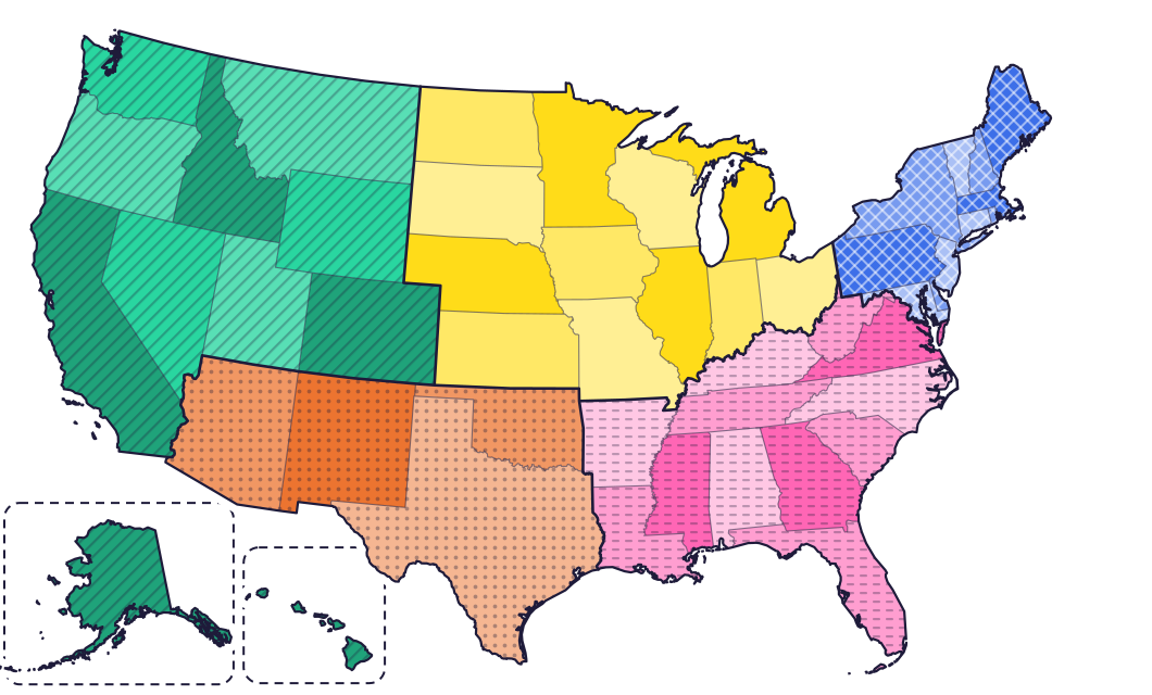
In alphabetical order, Alabama sits next to Alaska, and they are thousands of miles apart. Regions keep neighbors together and turn 50 states into five smaller groups, each with its own landscape to talk about.
Not everyone draws the regions the same way. The US Census Bureau uses four (Northeast, Midwest, South and West), and many classrooms use five. These are the five Map Otter uses:
| Region | States | What stands out |
|---|---|---|
| Northeast | 11, plus Washington, D.C. | Big cities, rocky coasts and the smallest states |
| Southeast | 12 | Warm weather, sandy beaches, swamps and the Appalachian Mountains |
| Midwest | 12 | Big farms and the Great Lakes |
| Southwest | 4 | Deserts, canyons and wide open skies |
| West | 11 | Tall mountains, the Pacific coast, Alaska and Hawaii |
Start with the region you live in, then move to a neighbor. The Southwest has just four states, which makes it a quick early win.
3. Find it, name it, then learn its capital
For most kids, pointing to a state when they hear its name is easier than naming a state you point to. Use that order:
- Find it. “Where’s Utah?” Your kid points.
- Name it. You point, and your kid says the name.
- Add the capital. Once a state is easy to find and name, its capital has something to stick to.
Shapes help along the way. Michigan’s lower half looks like a mitten, Oklahoma like a pan with a handle, and Louisiana like a boot. Let kids make up their own: the silly ones stick best.
4. A little, often
Ten minutes on most days does more than one long session a week. Two well-studied ideas explain why. Spacing: coming back to something after a break helps it last. Retrieval practice: pulling an answer out of memory strengthens it more than looking at it again. A large review of study techniques rated both as highly useful for learners of different ages (Dunlosky and colleagues, 2013).
At home, that means:
- Quiz, don’t reread. “Which state is this?” does more than looking at a labeled map.
- Bring tricky states back sooner, and easy ones later.
- Stop while it’s still fun. Ending on a win makes tomorrow easier.
5. Make it hands-on
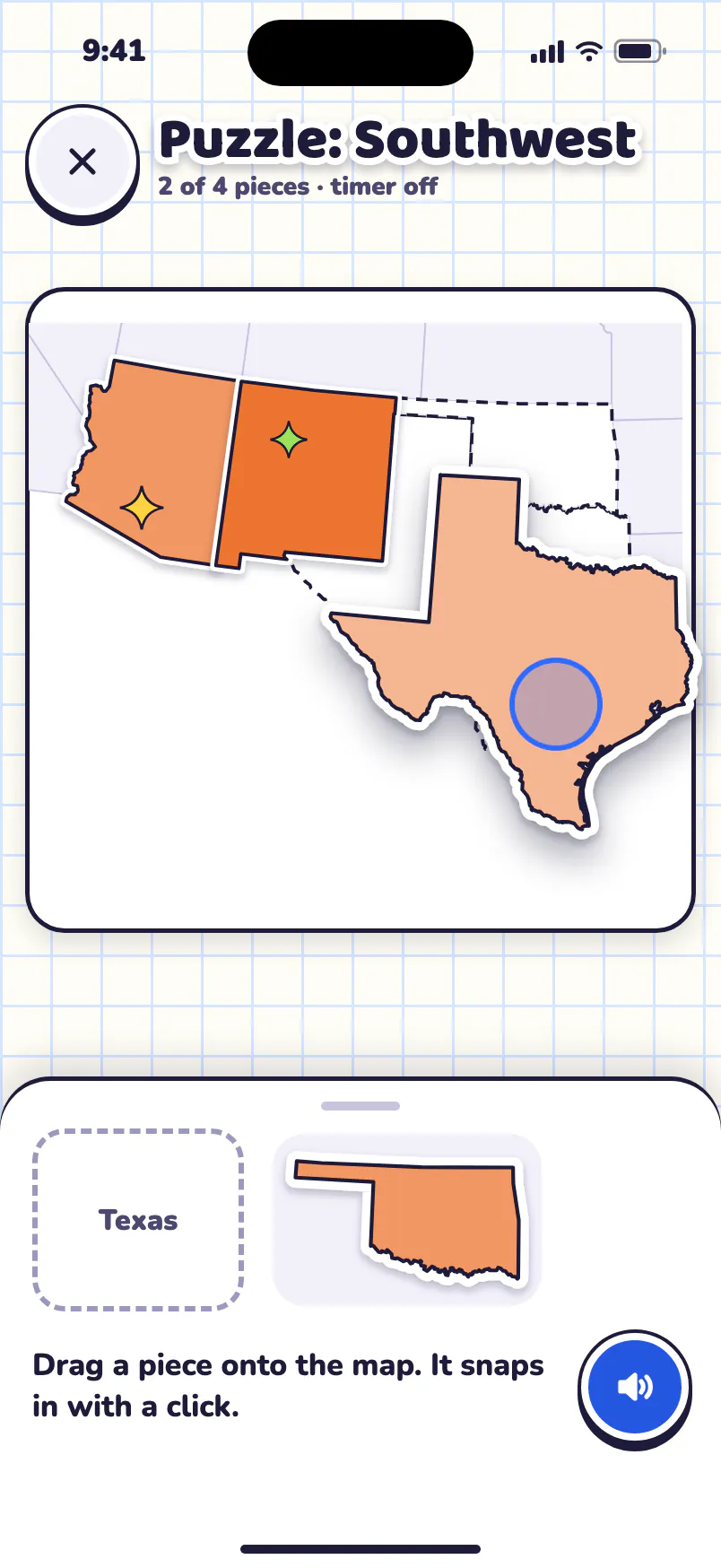
- A puzzle map. Fitting the pieces teaches shapes and neighbors at the same time.
- The license plate game. On a drive, spot plates from other states, then find each one on the map at home.
- A map on the wall. Ask quick questions during the day: “Which state is just north of Texas?” Our free printable US maps include one with every state’s name.
- A mystery state. Give clues one at a time: its region, its shape, a neighbor, something it’s known for. Fewer clues, bigger win.
- Songs. Fifty-states songs help with the names. Then go back to the map, because a song in A-to-Z order doesn’t teach where the states are.
What to expect at each age
Every kid is different. Treat these ages as rough starting points.
Pre-K to 1st grade
Big ideas first: we live in the United States, on a continent, next to oceans. The shape of your home state, and the animals that live in different places. No reading needed, and no list of 50 yet.
2nd to 4th grade
The core years for states: regions, names, your home state and its neighbors, then capitals for kids who are ready. Many schools study their own state’s history around 4th grade.
5th to 7th grade
All 50 states and their capitals, then latitude and longitude, rivers and mountains, and the countries of the world.
A 10-minute routine
For kids about 7 and up:
- 2 minutes: warm up. Find three states from last time.
- 4 minutes: one region. Find each state in it, then name them.
- 2 minutes: two capitals. Link each one to something your kid knows: a team, a relative, a trip.
- 2 minutes: a mystery state. Clues, a guess, done.
Questions parents ask
When do kids learn the 50 states in school?
There’s no national schedule: each state sets its own social studies standards. Many schools study their own state’s history around 4th grade, and the regions of the US come up in the grades around it. Your kid’s school can tell you what this year’s class covers.
Should kids learn the capitals at the same time?
Usually after. A capital is easier to remember once the state is easy to find and name.
Do kids need to learn the states in alphabetical order?
No. A-to-Z songs help with the names, but regions are what teach where each state is.
How long does it take to learn all 50?
There’s no set time, and it varies a lot from kid to kid. A few minutes on most days, one region at a time, with tricky states coming back sooner, adds up, and it lasts.
How Map Otter helps
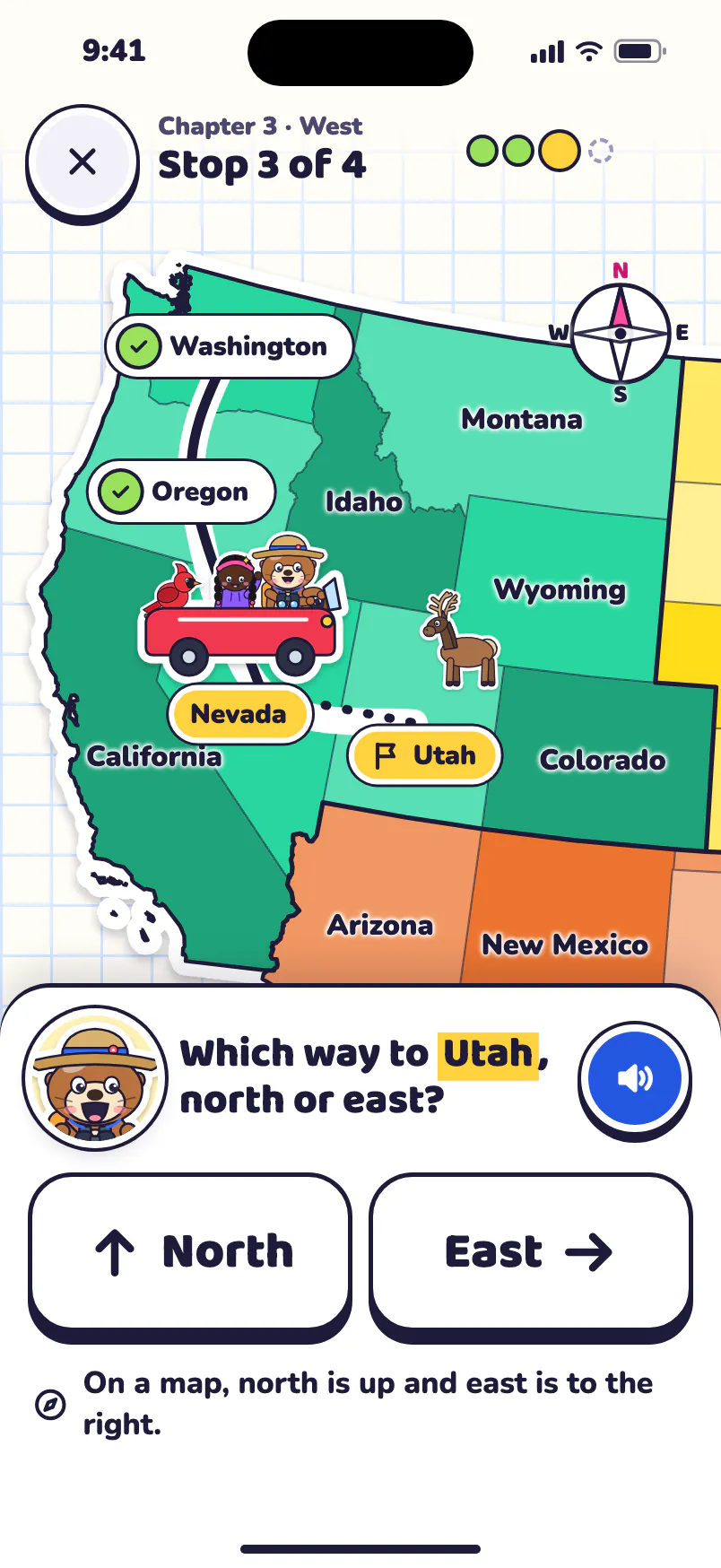
Map Otter, the geography app we’re building for kids 4 to 13, uses these same ideas. Kids start by exploring their own home state. The Puzzle Map teaches shapes and neighbors, Road Trips go region by region, and the Daily Mystery is a clue puzzle where fewer clues earn more stars. Each place keeps its own review schedule, so tricky states come back sooner. There are no ads, no tracking and no accounts.
Map Otter is coming soon to iPhone, iPad, Android phones and tablets, and Chromebooks.
