
Mississippi facts for kids
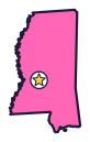

Mississippi is the Magnolia State (say mis-uh-SIP-ee), and it shares its name with a mighty river. The teddy bear got its name on a hunting trip here, and the blues were born here too.
Quick answers
- Where is Mississippi?
- Mississippi is in the Southeast region of the United States. It touches four states: Alabama, Arkansas, Louisiana and Tennessee.
- What is the capital of Mississippi?
- Jackson. It’s also the biggest city.
- Does Mississippi touch the ocean?
- Yes. Mississippi has a coast on the Gulf, which is part of the Atlantic Ocean.
- How big is Mississippi?
- 48,432 square miles. It’s the 32nd biggest of the 50 states.
Mississippi at a glance
- Capital
- Jackson
- Nickname
- The Magnolia State
- Region
- Southeast in Map Otter. The US Census Bureau puts it in the South.
- Became a state
- December 10, 1817, the 20th state
- Biggest city
- Jackson
- Size
- 48,432 square miles, the 32nd biggest
- People
- About 3 million (2025), the 35th most
- Neighbors
- Alabama, Arkansas, Louisiana and Tennessee
Where is Mississippi?
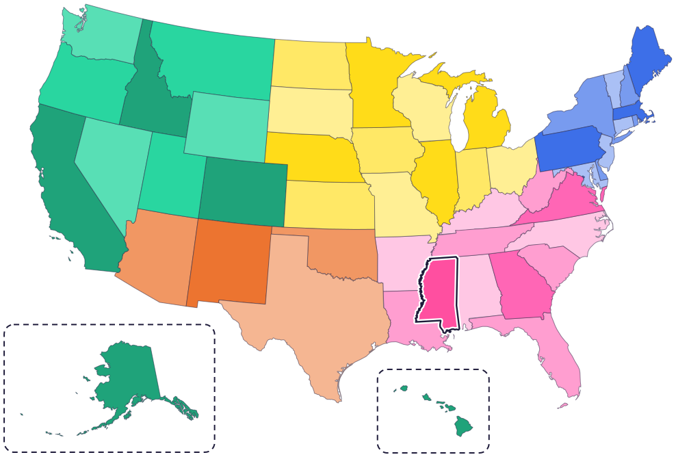
Mississippi is in the southeastern part of the country. Four states border it: Tennessee to the north, Alabama to the east, Louisiana to the southwest and Arkansas to the northwest.
The Mississippi River forms most of its western border, with Arkansas and Louisiana on the other side. In the southeast corner is the Mississippi Gulf Coast, with beaches, bays and islands out in the water.
Fun facts
- 1
The teddy bear is Mississippi’s state toy. In 1902, on a hunting trip in Mississippi, President Theodore “Teddy” Roosevelt refused to shoot a bear that had been tied to a tree, and a shop owner made a stuffed bear he called “Teddy’s Bear.”
- 2
Mississippi’s flag, adopted in 2021, has a magnolia blossom inside a circle of stars. A gold star stands for the state’s first peoples, its Native American tribes.
- 3
Mississippi has two state land mammals, the white-tailed deer and the red fox. Its state water mammal is the bottlenose dolphin.
- 4
The state fossil is a prehistoric whale, and the state stone is petrified wood: wood that has turned to stone.
- 5
Mississippi is where the blues were born, and the blues are a big root of today’s popular music.
Places to know
Vicksburg National Military Park
Vicksburg
In 1863, the Union army surrounded Vicksburg for 47 days, until the Confederate army surrendered on July 4. More than 1,400 monuments and memorials stand on the battlefield today.

Natchez Trace Parkway
From Natchez, north through the state
A 444-mile scenic road through Mississippi, Alabama and Tennessee. It follows the Old Natchez Trace, a path people have walked for thousands of years, and passes Emerald Mound near Natchez.
Ship Island
Gulf Islands National Seashore, off Gulfport
A barrier island about 12 miles off the coast that you can only reach by boat. A ferry runs from Gulfport between March and October, and the island has a swim beach and a historic fort.
Mississippi long ago
Mississippian people begin building Emerald Mound, near what is now Natchez. It covers eight acres, and it’s the second-largest mound of its kind in the country.
On December 10, Mississippi becomes the 20th state.
Between 1831 and 1838, more than 13,000 Choctaw people are forced to leave their homeland for what is now Oklahoma, where the Choctaw Nation of Oklahoma is today. About 6,000 refuse to go. They form the Mississippi Band of Choctaw Indians, whose home is in Mississippi, centered in the town of Choctaw.
On January 9, Mississippi votes to leave the United States. Its leaders say they are doing it to protect slavery. The Civil War soon follows.
On July 4, after a 47-day siege, the Confederate army at Vicksburg surrenders to the Union army. As many as 20,000 enslaved people then come to Vicksburg seeking freedom.
During Freedom Summer, more than 700 student volunteers join local Black Mississippians and organizers to help Black voters register and to start Freedom Schools.
State symbols
- State water mammalBottlenose dolphinsince 1974
- State birdMockingbirdsince 1944
- State flowerMagnoliasince 1952
- State toyTeddy bearsince 2003
- State reptileAmerican alligatorsince 2005
Tricks to remember Mississippi
- Follow the river. The Mississippi River runs down most of the left side of the state, so the state and the river share a name and a border.
- Twins with Alabama. Mississippi and Alabama stand side by side like two tall twins. Each has a short strip of coast at the bottom, right where they meet.
- Jackson is close to the center. On the map, the capital sits near the middle of Mississippi.
To practice, print a blank US map and color in Mississippi, or find it in the 50 states quiz. Then try today’s mystery state: guess it from its shape, with a clue after each miss.
Teaching all 50? Read how to teach kids the 50 states and what age kids learn the states and capitals, or follow our free 36-week homeschool geography plan.
Mississippi in Map Otter
In Map Otter, kids find Mississippi on the map, learn its capital, and collect its stamp in their passport, with Otto guiding the way. These screenshots show how it looks with a few example states.



Map Otter is coming soon to iPhone, iPad, Android phones and tablets, and Chromebooks.
Questions kids ask
What is the capital of Mississippi?
Jackson. It’s near the middle of the state.
Why is Mississippi called the Magnolia State?
For the magnolia, its state flower and state tree. A magnolia blossom is in the middle of the state flag.
How do you spell Mississippi?
M-i-s-s-i-s-s-i-p-p-i. It has 11 letters: one M, four i’s, four s’s and two p’s.
What is the biggest city in Mississippi?
Jackson, which is also the capital.
Where these facts come from
- Mississippi Secretary of State: Blue Book, state symbols
- Mississippi Secretary of State: My Mississippi activity book
- National Park Service: the story of the teddy bear
- Mississippi Blues Commission: Mississippi Blues Trail
- National Park Service: Vicksburg National Military Park
- National Park Service: the siege of Vicksburg
- National Park Service: Natchez Trace Parkway
- National Park Service: Ship Island
- National Park Service: Emerald Mound
- National Park Service: early Choctaw history
- National Park Service: Mississippi’s secession
- National Park Service: July 4, 1863, slavery ends in Vicksburg
- US Senate Manual: states admitted into the Union
- National Archives: Freedom Summer, 50 years later (2014 news release)
- US Census Bureau: state area measurements
- US Census Bureau: state population estimates, 2020 to 2025
- US Census Bureau: city and town population estimates, 2020 to 2025
- US Senate Manual: ratification of the Constitution by the 13 original states
- US Census Bureau: census regions and divisions
- NOAA Office for Coastal Management: shoreline mileage of the United States
