
South Dakota facts for kids
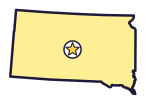
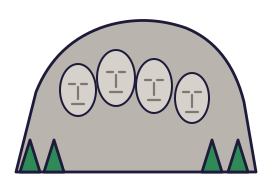

Four giant presidents’ faces look out from the Black Hills of South Dakota, the Mount Rushmore State (say sowth duh-KOH-tuh). Bison roam its prairies.
Quick answers
- Where is South Dakota?
- South Dakota is in the Midwest region of the United States. It touches six states: Iowa, Minnesota, Montana, Nebraska, North Dakota and Wyoming.
- What is the capital of South Dakota?
- Pierre. The biggest city is Sioux Falls.
- Does South Dakota touch the ocean?
- No. South Dakota doesn’t touch an ocean or any of the Great Lakes.
- How big is South Dakota?
- 77,116 square miles. It’s the 17th biggest of the 50 states.
South Dakota at a glance
- Capital
- Pierre
- Nickname
- The Mount Rushmore State
- Region
- Midwest in Map Otter. The US Census Bureau puts it in the Midwest.
- Became a state
- November 2, 1889, the 40th state
- Biggest city
- Sioux Falls
- Size
- 77,116 square miles, the 17th biggest
- People
- About 940,000 (2025), the 46th most
- Neighbors
- Iowa, Minnesota, Montana, North Dakota, Nebraska and Wyoming
Where is South Dakota?
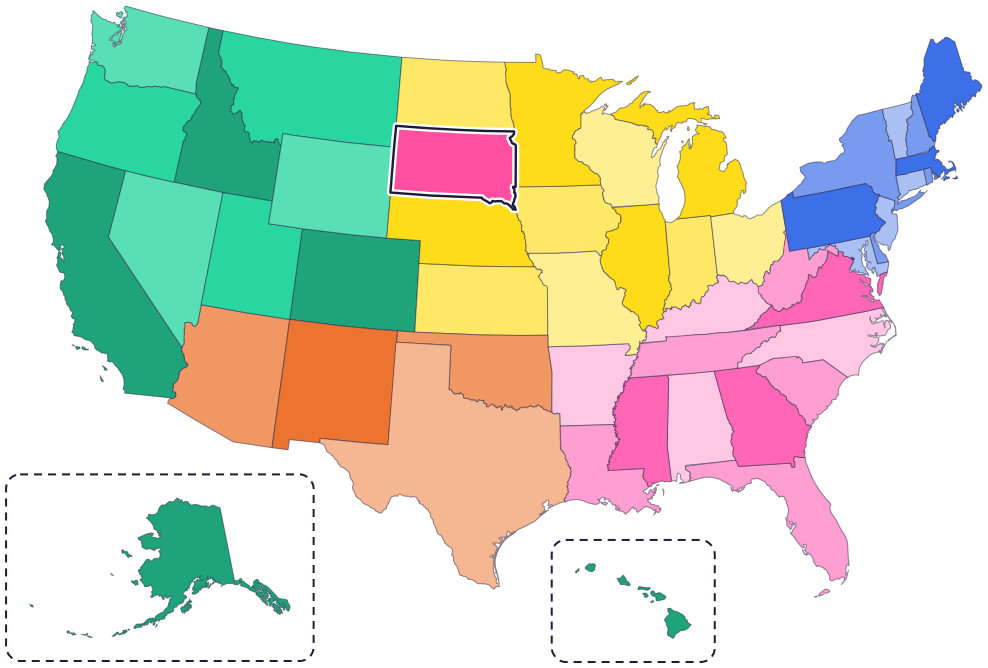
South Dakota is in the Midwest, in the north-central part of the country. It touches six states: North Dakota to the north, Minnesota to the east, Iowa to the southeast, Nebraska to the south, Wyoming to the west and Montana to the northwest.
The Missouri River flows through the middle of the state from north to south, then forms part of its border with Nebraska. The Big Sioux River forms its border with Iowa.
Fun facts
- 1
Workers used dynamite to carve about 90% of Mount Rushmore. In 14 years of work, no one died.
- 2
The state fossil is Triceratops, a dinosaur with three horns.
- 3
The state dessert is kuchen (say KOO-kuhn).
- 4
The state flower, the American pasque flower, comes with its own motto: “I lead.”
- 5
South Dakota and North Dakota became states on the same day, and no one knows which one came first.
Places to know
Mount Rushmore
Black Hills, near Keystone
Giant faces of George Washington, Thomas Jefferson, Theodore Roosevelt and Abraham Lincoln are carved into the mountain. Nearly 400 men and women worked on it.

Badlands National Park
Near Wall
Its rugged rocks have sharp peaks and one of the world’s richest fossil beds. Ancient horses and rhinos once lived here. Today bison, bighorn sheep and prairie dogs do.
Wind Cave National Park
Near Hot Springs
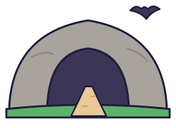
It’s one of the longest and most complex caves in the world, with a rare cave feature called boxwork. Above it, several hundred bison roam the prairie.
South Dakota long ago
Many Native nations have called this land home. The Black Hills are an important historical, spiritual and cultural place to many tribal nations, such as the Oglala Sioux Tribe, the Rosebud Sioux Tribe and the Cheyenne River Sioux Tribe.
French explorers bury a lead plate at today’s Fort Pierre. Much later it is found, and you can see it today at the state history museum in Pierre.
Dakota Territory is created. At first it includes both of today’s Dakotas, plus what are now Montana and Wyoming.
On November 2, South Dakota and North Dakota both become states.
Wind Cave becomes a national park, the first one made to protect a cave.
Workers carve Mount Rushmore.
State symbols
- State animalCoyotesince 1949
- State birdRing-necked pheasantsince 1943
- State fossilTriceratopssince 1988
- State dessertKuchensince 2000
Tricks to remember South Dakota
- South sits under North. South Dakota is right below North Dakota, just like the names say.
- The river splits it. The Missouri River runs down the middle, cutting the state into an east half and a west half.
- Rushmore is in the corner. Mount Rushmore and the Black Hills are in the southwest corner, next to Wyoming.
- Pierre sounds like “peer.” The capital is on the Missouri River, near the middle of the state.
To practice, print a blank US map and color in South Dakota, or find it in the 50 states quiz. Then try today’s mystery state: guess it from its shape, with a clue after each miss.
Teaching all 50? Read how to teach kids the 50 states and what age kids learn the states and capitals, or follow our free 36-week homeschool geography plan.
South Dakota in Map Otter
In Map Otter, kids find South Dakota on the map, learn its capital, and collect its stamp in their passport, with Otto guiding the way. These screenshots show how it looks with a few example states.



Map Otter is coming soon to iPhone, iPad, Android phones and tablets, and Chromebooks.
Questions kids ask
What is the capital of South Dakota?
Pierre (say PEER). It’s on the Missouri River, near the middle of the state.
Who is on Mount Rushmore?
George Washington, Thomas Jefferson, Theodore Roosevelt and Abraham Lincoln. Workers carved it from 1927 to 1941.
Why is it called the Mount Rushmore State?
For Mount Rushmore, in the Black Hills. South Dakota made it official in 1992.
What is the biggest city in South Dakota?
Sioux Falls, in the southeast corner of the state.
Where these facts come from
- South Dakota Codified Laws 1-6-16.5: state nickname
- South Dakota Codified Laws 1-6-8: state animal
- South Dakota Codified Laws 1-6-9: state bird
- South Dakota Codified Laws 1-6-10: state flower
- South Dakota Codified Laws 1-6-16.1: state fossil
- South Dakota Codified Laws 1-6-16.7: state dessert
- North Dakota state government: origin of the name and statehood
- National Park Service: Mount Rushmore National Memorial
- National Park Service: carving Mount Rushmore
- National Park Service: the associated tribal nations of Mount Rushmore
- National Park Service: Badlands National Park
- National Park Service: Wind Cave National Park
- National Park Service: nature at Wind Cave
- National Park Service: history and culture at Wind Cave
- South Dakota State Historical Society: museum education
- South Dakota State Historical Society: finding the Verendrye plate
- US Census Bureau: state area measurements
- US Census Bureau: state population estimates, 2020 to 2025
- US Census Bureau: city and town population estimates, 2020 to 2025
- US Senate Manual: ratification of the Constitution by the 13 original states
- US Senate Manual: states admitted into the Union
- US Census Bureau: census regions and divisions
- NOAA Office for Coastal Management: shoreline mileage of the United States
