
California facts for kids
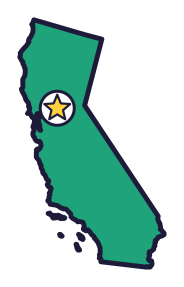
California, the Golden State (say kal-ih-FOR-nyuh), has the tallest trees in the world. The tallest mountain in the lower 48 states is here too, and so is the lowest point in North America.
Quick answers
- Where is California?
- California is in the West region of the United States. It touches three states: Arizona, Nevada and Oregon.
- What is the capital of California?
- Sacramento. The biggest city is Los Angeles.
- Does California touch the ocean?
- Yes. California has a coast on the Pacific Ocean.
- How big is California?
- 163,695 square miles. It’s the 3rd biggest of the 50 states.
California at a glance
- Capital
- Sacramento
- Nickname
- The Golden State
- Region
- West in Map Otter. The US Census Bureau puts it in the West.
- Became a state
- September 9, 1850, the 31st state
- Biggest city
- Los Angeles
- Size
- 163,695 square miles, the 3rd biggest
- People
- About 39.4 million (2025), the most of any state
- Neighbors
- Arizona, Nevada and Oregon
Where is California?
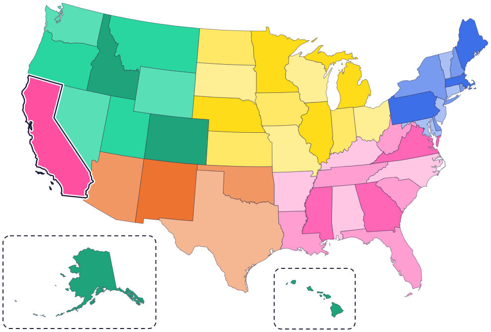
California is in the West, along the Pacific Ocean. Three states border it: Oregon to the north, Nevada to the east and Arizona to the southeast.
To the south is the country of Mexico. To the west is the Pacific Ocean. In the southeast, the Colorado River runs along the border with Arizona.
Fun facts
- 1
California’s flag has a grizzly bear on it. Grizzlies died out in California by the 1920s, and it’s the only state with an extinct animal on its flag and seal.
- 2
California has two state trees: the coast redwood, the tallest tree in the world, and the giant sequoia, which has more wood than any other tree.
- 3
Mount Whitney is the tallest mountain in the lower 48 states. Its top is 14,505 feet above sea level.
- 4
The state motto is “Eureka!” It’s a Greek word that means “I have found it!”
- 5
Up until 1969, California produced more gold than any other state: over 3,630 tons.
Places to know
Death Valley National Park
Eastern California
Badwater Basin is the lowest point in North America, 282 feet below sea level. In 1913, Furnace Creek reached 134°F, the hottest air temperature ever recorded in the world.
Redwood National and State Parks
Northern California coast
Coast redwoods here can grow 367 feet tall and live 2,000 years. Many reach 600 years old.
Sequoia National Park
Sierra Nevada mountains
The General Sherman Tree, a giant sequoia, is the largest tree in the world by volume. It’s about 275 feet tall.
California long ago
American Indians travel through and use the Yosemite area after the Ice Age glaciers melt. Today, seven tribes are traditionally associated with Yosemite, including the Southern Sierra Miwok.
James Marshall finds gold at Sutter’s sawmill in Coloma. It leads to the Gold Rush, the greatest mass movement of people in the Western Hemisphere.
On September 9, California becomes the 31st state. It never had to be a US territory first.
After meeting in San Jose, Vallejo and Benicia, the Legislature makes Sacramento the capital.
President Abraham Lincoln signs the Yosemite Grant, putting Yosemite under the protection of California.
State symbols
- State animalGrizzly bearsince 1953
- State birdCalifornia quailsince 1931
- State flowerCalifornia golden poppysince 1903
- State mineralGoldsince 1966
Tricks to remember California
- A tall state on the ocean. California is long from top to bottom, all along the Pacific coast. Its right side has a corner near the middle, where the border turns and slants down to the southeast.
- Sacramento is up and inland. The capital is in the top half of the state, away from the coast, in the middle of a big valley.
- Gold for the Golden State. Gold was found in 1848, gold is the state mineral, and the motto is “Eureka!”
- Look for the bear. California’s flag has a grizzly bear on it, the state animal.
To practice, print a blank US map and color in California, or find it in the 50 states quiz. Then try today’s mystery state: guess it from its shape, with a clue after each miss.
Teaching all 50? Read how to teach kids the 50 states and what age kids learn the states and capitals, or follow our free 36-week homeschool geography plan.
California in Map Otter
In Map Otter, kids find California on the map, learn its capital, and collect its stamp in their passport, with Otto guiding the way. These screenshots show how it looks with a few example states.



Map Otter is coming soon to iPhone, iPad, Android phones and tablets, and Chromebooks.
Questions kids ask
What is the capital of California?
Sacramento. San Jose, Vallejo and Benicia each had a turn first, and Sacramento took over in 1854.
Why is California called the Golden State?
California was linked with gold even before the Gold Rush of 1848, and gold is the state mineral. Golden State became the official nickname in 1968.
What is the biggest city in California?
Los Angeles. Next come San Diego and San Jose.
Was California ever a territory?
No. California became a state in 1850 without being a US territory first.
Where these facts come from
- California State Capitol Museum: state nickname
- California State Capitol Museum: state animal
- California State Capitol Museum: state bird
- California State Capitol Museum: state flower
- California State Capitol Museum: state trees
- California State Capitol Museum: state mineral
- California State Capitol Museum: state motto
- California State Capitol Museum: planning the Capitol (statehood and capitals)
- California State Parks: Marshall Gold Discovery State Historic Park
- National Park Service: Death Valley National Park
- National Park Service: Death Valley weather and climate
- National Park Service: Mount Whitney
- National Park Service: the General Sherman Tree
- National Park Service: Redwood, about the trees
- National Park Service: Yosemite, people
- US Census Bureau: 2025 city population estimates
- US Census Bureau: state area measurements
- US Census Bureau: state population estimates, 2020 to 2025
- US Census Bureau: city and town population estimates, 2020 to 2025
- US Senate Manual: ratification of the Constitution by the 13 original states
- US Senate Manual: states admitted into the Union
- US Census Bureau: census regions and divisions
- NOAA Office for Coastal Management: shoreline mileage of the United States
