
Arkansas facts for kids
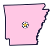

Arkansas (say AR-kuhn-saw) is the Natural State, a place of hot springs and diamonds. It also has the country’s first national river.
Quick answers
- Where is Arkansas?
- Arkansas is in the Southeast region of the United States. It touches six states: Louisiana, Mississippi, Missouri, Oklahoma, Tennessee and Texas.
- What is the capital of Arkansas?
- Little Rock. It’s also the biggest city.
- Does Arkansas touch the ocean?
- No. Arkansas doesn’t touch an ocean or any of the Great Lakes.
- How big is Arkansas?
- 53,179 square miles. It’s the 29th biggest of the 50 states.
Arkansas at a glance
- Capital
- Little Rock
- Nickname
- The Natural State
- Region
- Southeast in Map Otter. The US Census Bureau puts it in the South.
- Became a state
- June 15, 1836, the 25th state
- Biggest city
- Little Rock
- Size
- 53,179 square miles, the 29th biggest
- People
- About 3.1 million (2025), the 33rd most
- Neighbors
- Louisiana, Missouri, Mississippi, Oklahoma, Tennessee and Texas
Where is Arkansas?
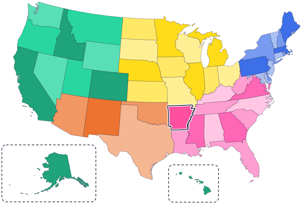
Arkansas is in the southern part of the country, just west of the Mississippi River. Its six neighbors are Missouri to the north, Tennessee and Mississippi to the east, Louisiana to the south, Texas to the southwest and Oklahoma to the west.
The Mississippi River forms most of its eastern border. In the north are the Ozark Mountains, where the Buffalo National River flows.
Fun facts
- 1
The name Arkansas comes from the Quapaw people, by way of French explorers. In 1881, lawmakers decided it is spelled “Arkansas” but said “Arkansaw.”
- 2
The US government set aside the hot springs at Hot Springs in 1832, 40 years before Yellowstone. That makes it the oldest of today’s national parks.
- 3
Diamonds were discovered in Pike County in 1906. It was the first diamond deposit found in the United States.
- 4
The state flag’s design won a statewide contest. Its big diamond showed that Arkansas was the nation’s only diamond-producing state.
- 5
Arkansas has four official songs. Two are state songs, one is the state anthem, and “The Arkansas Traveler” is the state historic song.
Places to know

Hot Springs National Park
Hot Springs
Water from the springs comes out of the ground at about 143°F. It fell as rain more than 4,000 years earlier! Walk Bathhouse Row to see the park’s historic bathhouses.

Buffalo National River
The Ozark Mountains
In 1972 it became the country’s first national river. About 135 miles of it flow freely past colorful bluffs, some more than 400 feet tall.

Little Rock Central High School
Little Rock
In 1957, nine Black students, the Little Rock Nine, went to school here when it was all-white. A national park visitor center tells their story.
Arkansas long ago
American Indians come to the hot springs area to dig novaculite, a hard stone, to make tools and weapons.
A French trading post, Arkansas Post, is set up at the Quapaw village of Osotouy. The Quapaw call themselves Ogaxpa, which means “downstream people.” Today the Quapaw Nation’s home is in Oklahoma.
On June 1, the government of the Arkansas Territory moves from Arkansas Post to Little Rock, looking for higher ground.
Arkansas is admitted as the 25th state, on June 15.
On May 20, during the Civil War, Arkansas joins the Confederate States of America.
Nine Black students, the Little Rock Nine, go to the all-white Central High School in Little Rock. After white mobs turn violent, President Dwight D. Eisenhower sends federal troops to escort the students into school.
State symbols
- State mammalWhite-tailed deersince 1993
- State birdMockingbirdsince 1929
- State flowerApple blossomsince 1901
- State treePinesince 1939
- State gemDiamondsince 1967
Tricks to remember Arkansas
- Say it right. Arkansas ends in “kansas,” but don’t say Kansas. Say AR-kuhn-saw, with a quiet s at the end.
- Little Rock is the bull’s-eye. Aim for the very center of Arkansas and you’ll land almost exactly on the capital.
- A missing corner. Arkansas is almost a square, but its top right corner has a bite taken out, where a small piece of Missouri pokes down.
- A wiggly right side. The east side of Arkansas is wiggly because it follows the Mississippi River.
To practice, print a blank US map and color in Arkansas, or find it in the 50 states quiz. Then try today’s mystery state: guess it from its shape, with a clue after each miss.
Teaching all 50? Read how to teach kids the 50 states and what age kids learn the states and capitals, or follow our free 36-week homeschool geography plan.
Arkansas in Map Otter
In Map Otter, kids find Arkansas on the map, learn its capital, and collect its stamp in their passport, with Otto guiding the way. These screenshots show how it looks with a few example states.



Map Otter is coming soon to iPhone, iPad, Android phones and tablets, and Chromebooks.
Questions kids ask
What is the capital of Arkansas?
Little Rock. The government of the Arkansas Territory moved there in 1821, looking for higher ground.
How do you say Arkansas?
AR-kuhn-saw. A law from 1881 says the name is spelled “Arkansas” but said “Arkansaw.”
Why is Arkansas called the Natural State?
For its natural beauty. The 1995 law that made the nickname official lists its scenery, clear lakes, free-flowing streams, rivers, forested mountains, and fish and wildlife.
Who are the Little Rock Nine?
Nine Black students who started at Little Rock’s all-white Central High School in 1957. Their story is told at Little Rock Central High School National Historic Site.
Where these facts come from
- Arkansas Secretary of State: how Arkansas got its name
- Arkansas Secretary of State: history timeline, 1541 to 1699
- Arkansas Secretary of State: history timeline, 1800s
- Arkansas Secretary of State: history timeline, 1900s and 2000s
- Arkansas Secretary of State: history of the state flag
- Arkansas Secretary of State: state songs
- Arkansas Game and Fish Commission: white-tailed deer
- National Park Service: Hot Springs history
- National Park Service: the hot springs
- National Park Service: Buffalo National River
- National Park Service: Little Rock Central High School history
- National Park Service: Arkansas Post history
- Quapaw Nation: name origin and history
- National Park Service: Hot Springs National Park
- National Park Service: Little Rock Central High School
- Arkansas Code, Title 1, Chapter 4: state symbols and nickname (Public.Resource.Org copy of the official code)
- US Census Bureau: state area measurements
- US Census Bureau: state population estimates, 2020 to 2025
- US Census Bureau: city and town population estimates, 2020 to 2025
- US Senate Manual: ratification of the Constitution by the 13 original states
- US Senate Manual: states admitted into the Union
- US Census Bureau: census regions and divisions
- NOAA Office for Coastal Management: shoreline mileage of the United States
