
Montana facts for kids
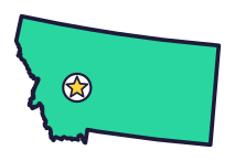
Montana (say mon-TAN-uh) is the Treasure State. It has glaciers and fossils of at least 75 kinds of dinosaurs. It also sent the first woman to Congress.
Quick answers
- Where is Montana?
- Montana is in the West region of the United States. It touches four states: Idaho, North Dakota, South Dakota and Wyoming.
- What is the capital of Montana?
- Helena. The biggest city is Billings.
- Does Montana touch the ocean?
- No. Montana doesn’t touch an ocean or any of the Great Lakes.
- How big is Montana?
- 147,040 square miles. It’s the 4th biggest of the 50 states.
Montana at a glance
- Capital
- Helena
- Nickname
- The Treasure State
- Region
- West in Map Otter. The US Census Bureau puts it in the West.
- Became a state
- November 8, 1889, the 41st state
- Biggest city
- Billings
- Size
- 147,040 square miles, the 4th biggest
- People
- About 1.1 million (2025), the 43rd most
- Neighbors
- Idaho, North Dakota, South Dakota and Wyoming
Where is Montana?
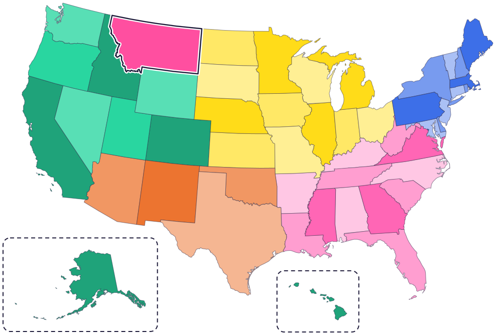
Montana is in the West, where the Rocky Mountains meet the Great Plains. Four states border it: North Dakota to the east, South Dakota to the southeast, Wyoming to the south and Idaho to the west and southwest.
To the north, Montana’s whole top edge touches Canada: the provinces of British Columbia, Alberta and Saskatchewan.
Fun facts
- 1
At least 75 different kinds of dinosaurs have been found in Montana.
- 2
In 1916, Jeannette Rankin of Montana became the first woman elected to the US Congress. Montana women had won the right to vote two years before.
- 3
The Crow people’s own name, Apsaalooke, means “children of the large-beaked bird.” Newcomers later mistranslated it as “Crow.”
- 4
Montana is home to many Native nations, including the Blackfeet, Crow, Northern Cheyenne, Chippewa Cree, Little Shell Chippewa, Assiniboine, Gros Ventre, Sioux, Salish, Pend d’Oreille and Kootenai.
- 5
A small part of Yellowstone National Park, about 3 percent, is in Montana. Most of it is in Wyoming.
Places to know
Glacier National Park
Northwest Montana
Named for its small glaciers. People have lived and traveled here for over 10,000 years, and you can drive the famous Going-to-the-Sun Road.

Little Bighorn Battlefield National Monument
South-central Montana
Here on June 25 and 26, 1876, Lakota, Cheyenne and Arapaho warriors fought an attack by the US Army’s 7th Cavalry, led by George Custer. An Indian Memorial honors all the tribes who took part.
Bannack
Southwest Montana
Montana’s best-preserved ghost town, with more than 50 old buildings still standing.
Montana long ago
People live and travel in the mountains that are now Glacier National Park. Some tribes call the area “the land of the shining mountains.”
A treaty sets up the Blackfeet Reservation in northwest Montana. Today it’s home to the Blackfeet Nation, right next to Glacier National Park.
On June 25 and 26, Lakota, Cheyenne and Arapaho warriors fight the US Army’s 7th Cavalry at the Little Bighorn.
Montana is admitted as the 41st state on November 8.
Glacier National Park is created.
State symbols
- State animalGrizzly bearsince 1983
- State flowerBitterrootsince 1895
- State fossilMaiasaurasince 1985
Tricks to remember Montana
- Canada on top. Montana’s whole northern edge touches Canada.
- Rockies west, plains east. The Rocky Mountains are in the west, and the Great Plains stretch across the east.
- A wiggly left side. Montana’s border with Idaho zigzags along mountain ridges, but its other borders are straight lines.
- Helena is in the mountains. The capital is in the western part of the state.
To practice, print a blank US map and color in Montana, or find it in the 50 states quiz. Then try today’s mystery state: guess it from its shape, with a clue after each miss.
Teaching all 50? Read how to teach kids the 50 states and what age kids learn the states and capitals, or follow our free 36-week homeschool geography plan.
Montana in Map Otter
In Map Otter, kids find Montana on the map, learn its capital, and collect its stamp in their passport, with Otto guiding the way. These screenshots show how it looks with a few example states.



Map Otter is coming soon to iPhone, iPad, Android phones and tablets, and Chromebooks.
Questions kids ask
What is the capital of Montana?
Helena (say HEL-uh-nuh), in the western part of the state.
What is the biggest city in Montana?
Billings. Next comes Missoula.
Where is Glacier National Park?
In northwest Montana, right next to the Blackfeet Reservation.
Where these facts come from
- Visit Montana: history
- Visit Montana: tribes
- Visit Montana: Niitsitapi Blackfeet
- Visit Montana: Apsaalooke Crow
- Blackfeet Nation
- National Park Service: Glacier
- National Park Service: learn about Glacier
- National Park Service: how Glacier got its name
- National Park Service: Little Bighorn Battlefield
- National Park Service: Yellowstone park facts
- US House of Representatives history: Jeannette Rankin
- Montana Code 1-1-508: state animal
- Montana Historical Society: Montana state symbols
- Montana Legislature: state symbols (Economic Affairs Interim Committee, September 2023)
- US Census Bureau: state area measurements
- US Census Bureau: state population estimates, 2020 to 2025
- US Census Bureau: city and town population estimates, 2020 to 2025
- US Senate Manual: ratification of the Constitution by the 13 original states
- US Senate Manual: states admitted into the Union
- US Census Bureau: census regions and divisions
- NOAA Office for Coastal Management: shoreline mileage of the United States
