
Delaware facts for kids

Delaware (say DEL-uh-wair) is the First State, because it was the first to approve the US Constitution. Its state bird is a chicken, and second graders helped pick its state bug.
Quick answers
- Where is Delaware?
- Delaware is in the Northeast region of the United States. It touches three states: Maryland, New Jersey and Pennsylvania.
- What is the capital of Delaware?
- Dover. The biggest city is Wilmington.
- Does Delaware touch the ocean?
- Yes. Delaware has a coast on the Atlantic Ocean.
- How big is Delaware?
- 2,489 square miles. It’s the 49th biggest of the 50 states.
Delaware at a glance
- Capital
- Dover
- Nickname
- The First State
- Region
- Northeast in Map Otter. The US Census Bureau puts it in the South.
- Became a state
- December 7, 1787, one of the 13 original states (the 1st to approve the Constitution)
- Biggest city
- Wilmington
- Size
- 2,489 square miles, the 49th biggest
- People
- About 1.1 million (2025), the 45th most
- Neighbors
- Maryland, New Jersey and Pennsylvania
Where is Delaware?
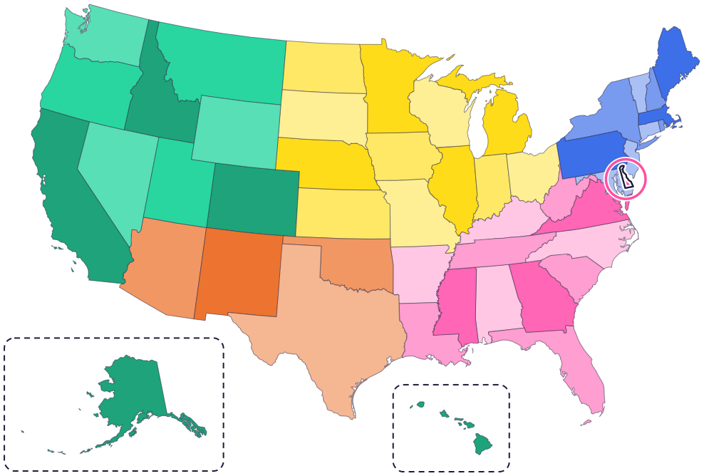
Delaware is on the East Coast, on a peninsula it shares with Maryland and Virginia. It touches three states: Pennsylvania to the north, Maryland to the west and south, and New Jersey to the east, across the Delaware River and Delaware Bay.
To the east are the Delaware Bay and the Atlantic Ocean, with sandy beaches along the coast. Delaware’s border with Pennsylvania is curved, which makes the state easy to spot on a map.
Fun facts
- 1
Delaware’s state bug is the ladybug. A teacher and her second graders in Milford worked hard to make it happen, and it became official in 1974.
- 2
The state bird is a chicken, the Blue Hen. In the Revolutionary War, Delaware soldiers carried Blue Hen chickens, and people said the soldiers fought as bravely as the tough birds.
- 3
Each spring, hundreds of thousands of horseshoe crabs crawl onto Delaware Bay beaches to lay eggs. Shorebirds called red knots eat so many eggs that they double their weight in about two weeks.
- 4
Delaware is named after the Delaware Bay, which was named in 1610 for Lord De La Warr, the governor of Virginia. He never saw the bay!
- 5
The state star is called the Delaware Diamond. It’s a star in the constellation Ursa Major, the Great Bear.
Places to know

Zwaanendael Museum
Lewes
Lewes was once home to a short-lived Dutch colony called Swanendael, or “Swan Valley.” At this museum, kids love the “merman,” made long ago as a prank from a monkey’s head and a fish’s body.
Fort Christina
Wilmington
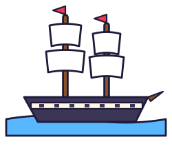
More than 375 years ago, the first Swedish and Finnish settlers landed here on the ships Kalmar Nyckel and Fogel Grip, and started a colony called New Sweden.

The Green
Dover
This town square was laid out in 1717, following a plan William Penn made in 1683. You can also take a guided tour of the Old State House.
Delaware long ago
Lenape people (say len-NAH-pay), whose name means about “the People,” live along the Delaware River. Europeans call them the Delaware. Later, many Lenape are pushed west. Today the Delaware Tribe of Indians’ home is in Bartlesville, Oklahoma.
New Castle becomes the capital of the “Three Lower Counties,” which are part of Pennsylvania.
On June 15, Delaware’s Assembly declares an end to its status as a colony of Great Britain.
The capital moves from New Castle to Dover.
On December 7, Delaware becomes the first of the 13 original states to approve the US Constitution.
During the War of 1812, British ships fire their cannons at the town of Lewes for 22 hours. The town holds out until the ships sail away.
State symbols
- State wildlife animalGray foxsince 2010
- State birdBlue hen chickensince 1939
- State flowerPeach blossomsince 1895
- State treeAmerican hollysince 1939
- State marine animalHorseshoe crabsince 2002
Tricks to remember Delaware
- Look for the curved top. Delaware’s border with Pennsylvania is a curve, like part of a circle.
- Del-Mar-Va. Delaware shares a peninsula with parts of Maryland and Virginia. Put the first letters together and you get Delmarva.
- First state, first in line. Delaware was the first state to approve the Constitution, so on a list of states in the order they joined, it always comes first.
- Dover is in the middle. The capital, Dover, is near the middle of the state.
To practice, print a blank US map and color in Delaware, or find it in the 50 states quiz. Then try today’s mystery state: guess it from its shape, with a clue after each miss.
Teaching all 50? Read how to teach kids the 50 states and what age kids learn the states and capitals, or follow our free 36-week homeschool geography plan.
Delaware in Map Otter
In Map Otter, kids find Delaware on the map, learn its capital, and collect its stamp in their passport, with Otto guiding the way. These screenshots show how it looks with a few example states.



Map Otter is coming soon to iPhone, iPad, Android phones and tablets, and Chromebooks.
Questions kids ask
What is the capital of Delaware?
Dover. The capital moved there from New Castle in 1777.
Why is Delaware called the First State?
On December 7, 1787, it was the first of the 13 original states to approve the US Constitution. It has been the official nickname since 2002.
Is Delaware the smallest state?
No. Rhode Island is smaller. Delaware is the second smallest.
What is the biggest city in Delaware?
Wilmington, in the north of the state. It’s bigger than Dover, the capital.
Where these facts come from
- State of Delaware: Delaware facts and symbols
- Delaware Code, Title 29, Chapter 3: state symbols
- Delaware DNREC: where Delaware’s place names come from
- Delaware DNREC: horseshoe crabs
- Delaware Division of Historical and Cultural Affairs: Lewes and the Delaware Bay
- Delaware Tribe of Indians: about us
- National Park Service: Fort Christina
- National Park Service: The Green in Dover
- US Census Bureau: state area measurements
- US Census Bureau: state population estimates, 2020 to 2025
- US Census Bureau: city and town population estimates, 2020 to 2025
- US Senate Manual: ratification of the Constitution by the 13 original states
- US Senate Manual: states admitted into the Union
- US Census Bureau: census regions and divisions
- NOAA Office for Coastal Management: shoreline mileage of the United States
