
Utah facts for kids

Utah is the Beehive State (say YOO-tah). One of its parks has more than 2,000 stone arches, and it also has a cliff full of dinosaur bones. The first railroad across the country was finished here.
Quick answers
- Where is Utah?
- Utah is in the West region of the United States. It touches five states: Arizona, Colorado, Idaho, Nevada and Wyoming. It also meets New Mexico at a single point, the Four Corners.
- What is the capital of Utah?
- Salt Lake City. It’s also the biggest city.
- Does Utah touch the ocean?
- No. Utah doesn’t touch an ocean or any of the Great Lakes.
- How big is Utah?
- 84,897 square miles. It’s the 13th biggest of the 50 states.
Utah at a glance
- Capital
- Salt Lake City
- Nickname
- The Beehive State
- Region
- West in Map Otter. The US Census Bureau puts it in the West.
- Became a state
- January 4, 1896, the 45th state
- Biggest city
- Salt Lake City
- Size
- 84,897 square miles, the 13th biggest
- People
- About 3.5 million (2025), the 30th most
- Neighbors
- Arizona, Colorado, Idaho, Nevada and Wyoming
Where is Utah?
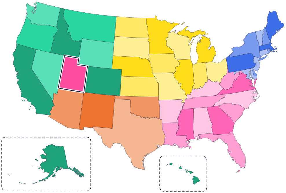
Utah is in the West, in the Rocky Mountain region. Its five neighbors are Idaho to the north, Wyoming to the northeast, Colorado to the east, Arizona to the south and Nevada to the west.
Utah has no coast and doesn’t touch another country. Its borders are straight lines, with a notch cut out of the top right corner where Wyoming fits in.
Fun facts
- 1
Kings Peak, in the Uinta Mountains, is Utah’s highest point. It’s 13,528 feet tall.
- 2
The name Utah may come from the Ute people; the Ute Indian Tribe, based in Fort Duchesne, Utah, says “Ute” means “Land of the Sun.” Another idea is that it comes from an Apache word, “yuttahih.”
- 3
Utah has a state star, Dubhe, and a state astronomical symbol, the Beehive Cluster.
- 4
Utah even has a state cooking pot, the Dutch oven, and a state crustacean, the brine shrimp.
- 5
At Dinosaur National Monument, more than 1,500 dinosaur fossils stick out of a cliff wall inside the Quarry Exhibit Hall. The dinosaurs lived about 150 million years ago.
Places to know
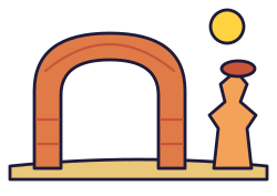
Arches National Park
Eastern Utah, near Moab
More than 2,000 natural stone arches. Delicate Arch may be the most famous natural arch in the world.
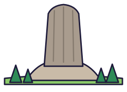
Bryce Canyon National Park
Southern Utah
Hoodoos, tall towers of rock, are found on every continent, but Bryce Canyon has more of them than anywhere else on Earth. It also has some of the darkest night skies in the country.

Golden Spike National Historical Park
Promontory, northern Utah
The first railroad across the country was finished here on May 10, 1869. Today, copies of the two engines that met here, Jupiter and No. 119, are moved to the spot where the last spike went in.
Utah long ago
Native people care for the land. Arches National Park is in the homelands of several tribal nations, including the Hopi Tribe, the Navajo Nation and the Ute Mountain Ute Tribe.
In February, the first wagons of Mormon pioneers leave Nauvoo, Illinois. Their leaders plan to move some 15,000 people west to the Great Basin, part of which is in Utah today.
On May 10, two railroads meet at Promontory, finishing the first railroad across the country.
Utah becomes the 45th state on January 4.
State symbols
- State animalRocky Mountain elksince 1971
- State flowerSego lilysince 1911
- State emblemBeehivesince 1959
Tricks to remember Utah
- A bite out of the corner. Utah looks like a rectangle with a bite taken out of its top right corner. Wyoming fills the bite.
- Four Corners. Utah’s bottom right corner touches Colorado, Arizona and New Mexico at a single point, called Four Corners.
- Busy as a bee. Utah is the Beehive State, and its motto is “Industry,” which means hard work.
- Salt Lake City is up top. The capital is in the northern part of the state, near the Great Salt Lake.
To practice, print a blank US map and color in Utah, or find it in the 50 states quiz. Then try today’s mystery state: guess it from its shape, with a clue after each miss.
Teaching all 50? Read how to teach kids the 50 states and what age kids learn the states and capitals, or follow our free 36-week homeschool geography plan.
Utah in Map Otter
In Map Otter, kids find Utah on the map, learn its capital, and collect its stamp in their passport, with Otto guiding the way. These screenshots show how it looks with a few example states.



Map Otter is coming soon to iPhone, iPad, Android phones and tablets, and Chromebooks.
Questions kids ask
What is the capital of Utah?
Salt Lake City, in the northern part of the state.
Why is Utah called the Beehive State?
The beehive is Utah’s state emblem, and the state motto is “Industry,” which means hard work.
What is the biggest city in Utah?
Salt Lake City, the capital. Next comes West Valley City.
Where did the first railroad across the country meet?
At Promontory, in northern Utah, on May 10, 1869. You can visit Golden Spike National Historical Park there.
Where these facts come from
- State of Utah: quick facts
- State of Utah: state symbols
- Utah Code 63G-1-601: state symbols
- Utah’s Online Library: Rocky Mountain elk
- Ute Indian Tribe
- National Park Service: Arches
- National Park Service: Arches history and culture
- National Park Service: Bryce Canyon
- National Park Service: Golden Spike
- National Park Service: Golden Spike history and culture
- National Park Service: Mormon Pioneer National Historic Trail history
- National Park Service: Dinosaur National Monument
- Utah’s Online Library: state flower
- Utah’s Online Library: state emblem
- US Census Bureau: state area measurements
- US Census Bureau: state population estimates, 2020 to 2025
- US Census Bureau: city and town population estimates, 2020 to 2025
- US Senate Manual: ratification of the Constitution by the 13 original states
- US Senate Manual: states admitted into the Union
- US Census Bureau: census regions and divisions
- NOAA Office for Coastal Management: shoreline mileage of the United States
- Navajo Nation Parks and Recreation: Four Corners Monument
