
Colorado facts for kids
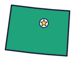
Colorado (say kol-uh-RAD-oh) is the Centennial State, because it became a state 100 years after the Declaration of Independence. It has more Rocky Mountain bighorn sheep than anywhere else, and the tallest sand dunes in North America.
Quick answers
- Where is Colorado?
- Colorado is in the West region of the United States. It touches six states: Kansas, Nebraska, New Mexico, Oklahoma, Utah and Wyoming. It also meets Arizona at a single point, the Four Corners.
- What is the capital of Colorado?
- Denver. It’s also the biggest city.
- Does Colorado touch the ocean?
- No. Colorado doesn’t touch an ocean or any of the Great Lakes.
- How big is Colorado?
- 104,094 square miles. It’s the 8th biggest of the 50 states.
Colorado at a glance
- Capital
- Denver
- Nickname
- The Centennial State
- Region
- West in Map Otter. The US Census Bureau puts it in the West.
- Became a state
- August 1, 1876, the 38th state
- Biggest city
- Denver
- Size
- 104,094 square miles, the 8th biggest
- People
- About 6 million (2025), the 20th most
- Neighbors
- Kansas, Nebraska, New Mexico, Oklahoma, Utah and Wyoming
Where is Colorado?
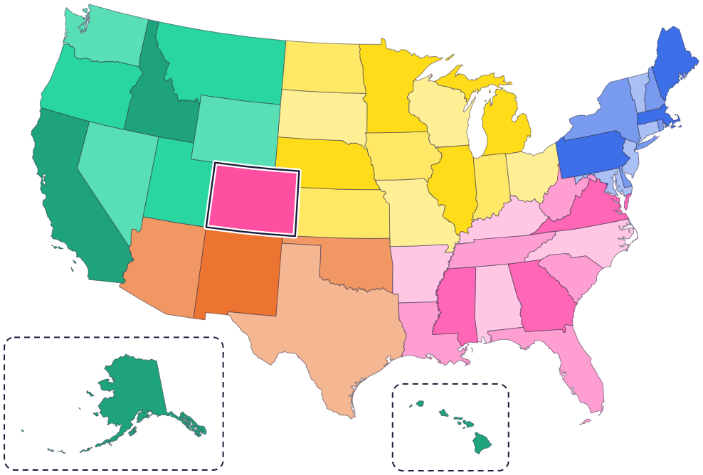
Colorado is in the West. It touches six states: Wyoming to the north, Nebraska to the northeast, Kansas to the east, Oklahoma to the southeast, New Mexico to the south and Utah to the west.
The Rocky Mountains run through the middle and west of the state, and flat plains cover the east.
Fun facts
- 1
The Southern Ute Indian Tribe says the Ute people are the oldest residents of Colorado. Two Ute tribes have their headquarters in Colorado today: the Southern Ute in Ignacio and the Ute Mountain Ute in Towaoc.
- 2
More Rocky Mountain bighorn sheep live in Colorado than anywhere else.
- 3
Colorado’s official state fossil is a dinosaur: the Stegosaurus.
- 4
The state reptile is the painted turtle. Painted turtles have lived in North America for 15 million years.
- 5
Colorado’s southwest corner is Four Corners, the only place in the United States where four states meet at one point: Colorado, Utah, Arizona and New Mexico.
Places to know
Mesa Verde National Park
Southwestern Colorado
For over 700 years, Ancestral Pueblo people built homes on the mesas and in the cliffs here. Cliff Palace, the park’s largest cliff dwelling, is nearly 800 years old.
Great Sand Dunes National Park
Southern Colorado
The tallest sand dunes in North America are here. In late spring of snowy years, you can float on the little waves of Medano Creek, near the dunes.
Rocky Mountain National Park
North-central Colorado
Over 415 square miles of mountains, with more than 900 kinds of wildflowers. Bighorn sheep, the park’s symbol, come down to a natural salt lick at Sheep Lakes.
Colorado long ago
Ancestral Pueblo people build Cliff Palace at Mesa Verde. Today, the park protects the heritage of 27 Pueblos and Tribes.
On August 1, President Ulysses S. Grant announces that Colorado is now a state.
Greenback cutthroat trout, thought to be extinct since 1937, are found again in the South Platte and Arkansas river basins.
The bighorn sheep becomes the state animal.
The greenback cutthroat trout becomes the state fish.
State symbols
- State animalBighorn sheepsince 1961
- State birdLark buntingsince 1931
- State flowerWhite and lavender columbinesince 1899
- State fishGreenback cutthroat troutsince 1994
- State gemAquamarinesince 1971
Tricks to remember Colorado
- Almost a rectangle. Colorado is shaped almost like a rectangle, wider than it is tall.
- Four Corners at the bottom left. Colorado’s bottom left corner is where it meets Utah, Arizona and New Mexico.
- Denver is up and to the right. From the center of Colorado, go up and a little to the right. The capital is there.
- Mountains on the left, plains on the right. The Rocky Mountains fill the middle and west of Colorado. The east is flat.
To practice, print a blank US map and color in Colorado, or find it in the 50 states quiz. Then try today’s mystery state: guess it from its shape, with a clue after each miss.
Teaching all 50? Read how to teach kids the 50 states and what age kids learn the states and capitals, or follow our free 36-week homeschool geography plan.
Colorado in Map Otter
In Map Otter, kids find Colorado on the map, learn its capital, and collect its stamp in their passport, with Otto guiding the way. These screenshots show how it looks with a few example states.



Map Otter is coming soon to iPhone, iPad, Android phones and tablets, and Chromebooks.
Questions kids ask
What is the capital of Colorado?
Denver, a little north and east of the middle of the state.
Why is Colorado called the Centennial State?
Colorado became a state in 1876, 100 years after the Declaration of Independence. A centennial is a 100th anniversary.
What is the biggest city in Colorado?
Denver. It’s the capital and the biggest city.
Where are the tallest sand dunes in North America?
In Great Sand Dunes National Park, in southern Colorado.
Where these facts come from
- The American Presidency Project: Proclamation 230, admission of Colorado into the Union (1876)
- Southern Ute Indian Tribe: history
- Ute Mountain Ute Tribe
- Colorado State Archives: symbols and emblems
- Colorado Parks and Wildlife: Rocky Mountain bighorn sheep
- Colorado Parks and Wildlife: greenback cutthroat trout
- Colorado Parks and Wildlife: painted turtle
- Navajo Nation Parks & Recreation: Four Corners Monument
- National Park Service: Mesa Verde National Park
- National Park Service: Mesa Verde, history and culture
- National Park Service: Great Sand Dunes National Park
- National Park Service: Rocky Mountain National Park
- National Park Service: Rocky Mountain, wildflowers
- National Park Service: Rocky Mountain, bighorn sheep
- Colorado Geological Survey: fossils
- Colorado Geological Survey: gemstones
- Colorado General Assembly: state symbols and emblems
- US Census Bureau: state area measurements
- US Census Bureau: state population estimates, 2020 to 2025
- US Census Bureau: city and town population estimates, 2020 to 2025
- US Senate Manual: ratification of the Constitution by the 13 original states
- US Senate Manual: states admitted into the Union
- US Census Bureau: census regions and divisions
- NOAA Office for Coastal Management: shoreline mileage of the United States
- Navajo Nation Parks and Recreation: Four Corners Monument
